Paper Maps
Paper maps are timeless tools that blend functionality with a touch of nostalgia, perfect for explorers, adventurers, and anyone who appreciates the art of navigation. These beautifully crafted maps offer a tangible way to chart your journeys, plan new adventures, or simply add a unique decorative element to your space.
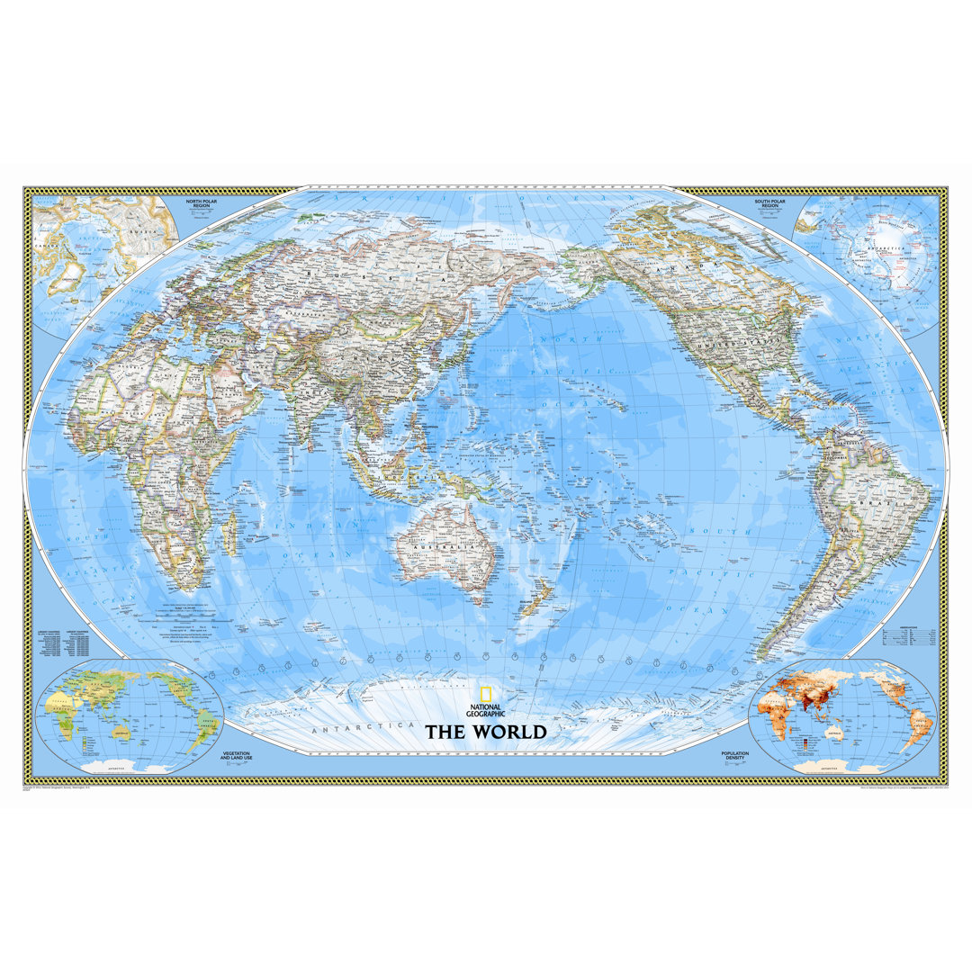
World Classic Wall Map National Geographic Maps
Rated 5.0 out of 5 stars. 24 total votes
A detailed world map with subtle border coloring, featuring the Winkel Tripel projection on paper.
Caribbean Classic - Tubed National Geographic Maps
Rated 5.0 out of 5 stars. 22 total votes
A detailed paper map of the Caribbean Sea, featuring over 1,000 named places and bathymetric details.
North America Classic Wall Map National Geographic Maps
Rated 5.0 out of 5 stars. 14 total votes
A detailed blue political map of North America on standard size paper, featuring country boundaries and more.
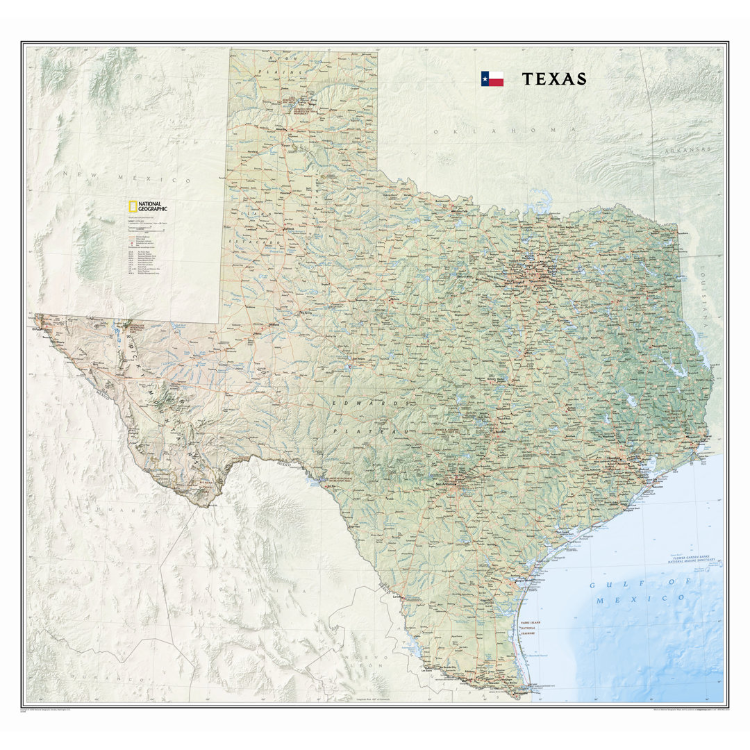
Texas State Wall Map National Geographic Maps
Rated 5.0 out of 5 stars. 11 total votes
A detailed Texas state wall map featuring diverse terrain, major landmarks, and precise locations, printed on paper.
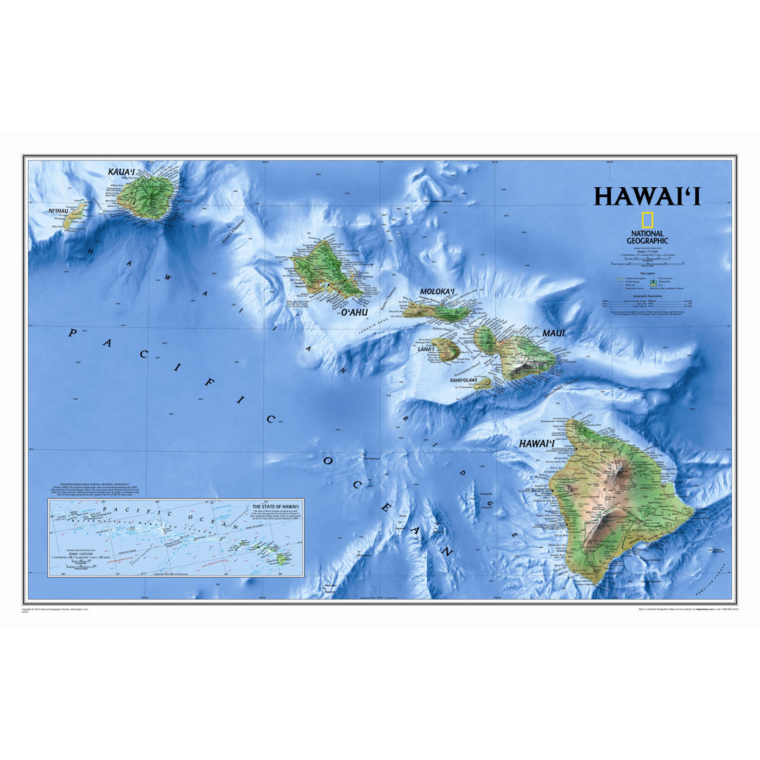
Hawaii State Wall Map National Geographic Maps Map
Rated 5.0 out of 5 stars. 9 total votes
A visually stunning paper map showcasing Hawaii's major islands and underwater features in traditional blue.
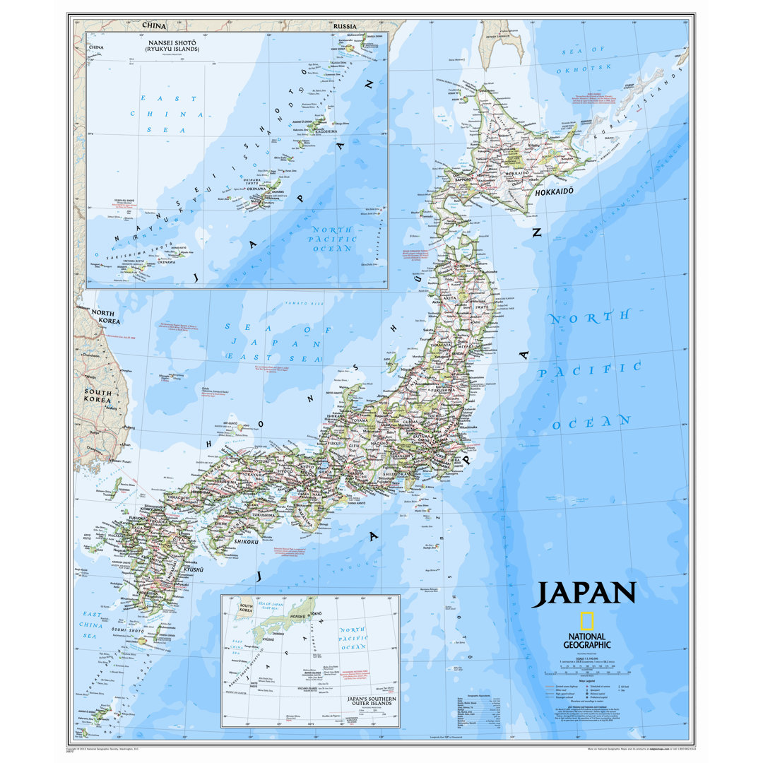
Japan Classic Wall Map National Geographic Maps
Rated 4.5 out of 5 stars. 7 total votes
A traditional blue paper map of Japan detailing political boundaries, highways, cities, and geographic features.
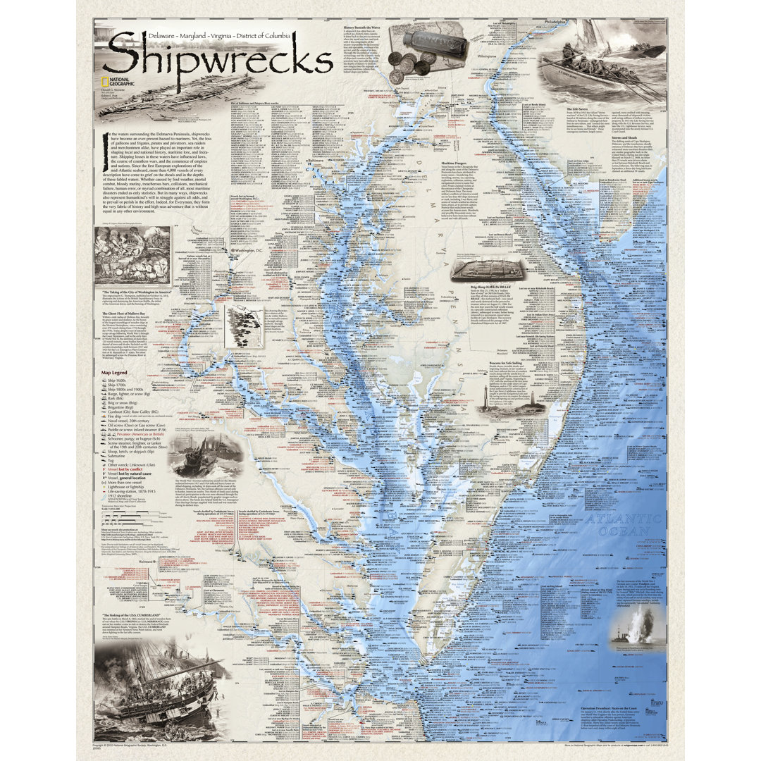
Shipwrecks of Delmarva Wall Map National Geographic Maps
Rated 5.0 out of 5 stars. 7 total votes
A detailed paper map showcasing over 2,400 shipwrecks off Delmarva's coast in traditional blue.
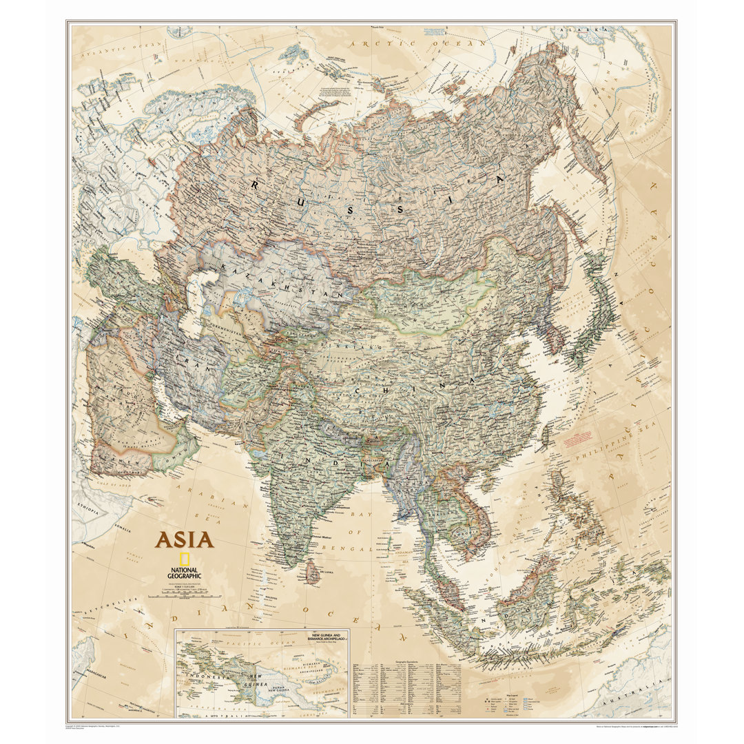
Asia Executive Wall Map National Geographic Maps
Rated 5.0 out of 5 stars. 5 total votes
An antique-style paper wall map detailing Asia's geography, measuring 38'' x 33''.
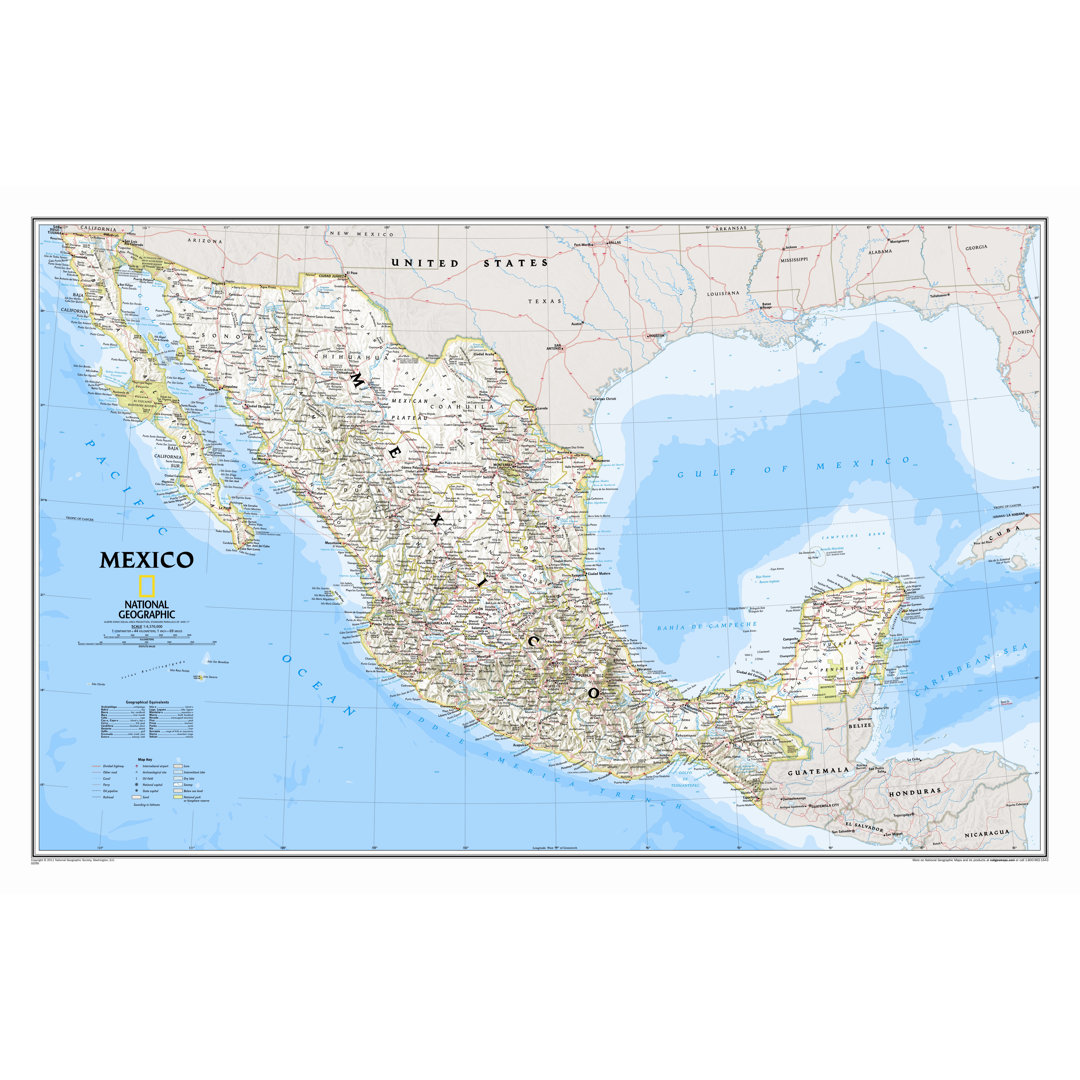
Mexico Classic Wall Map National Geographic Maps Map
Rated 5.0 out of 5 stars. 5 total votes
A detailed laminated wall map of Mexico featuring place names, political boundaries, and diverse terrain.
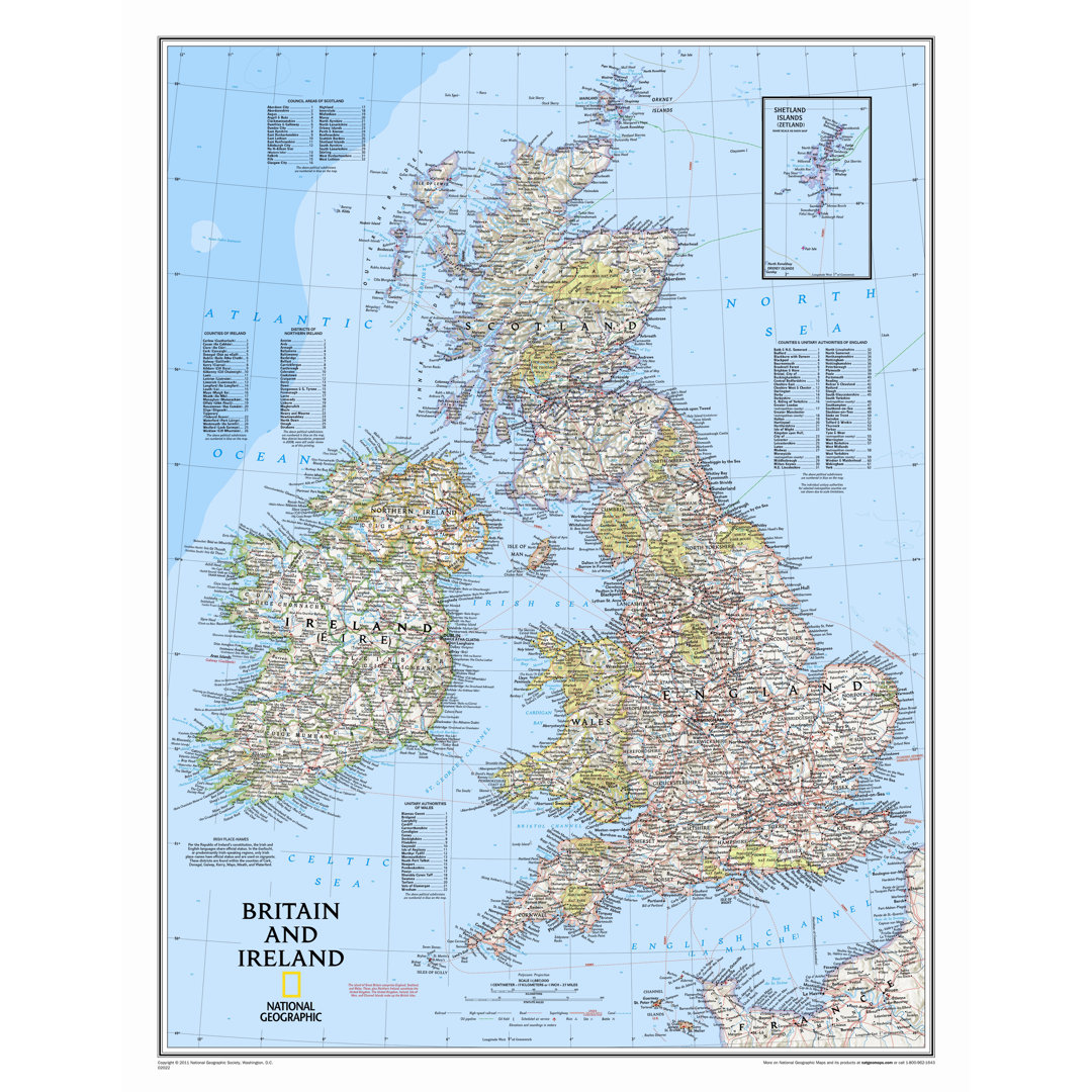
Britain and Ireland Wall Map National Geographic Maps Map
Rated 5.0 out of 5 stars. 4 total votes
A laminated political map of Britain and Ireland featuring boundaries, highways, and thousands of place names.
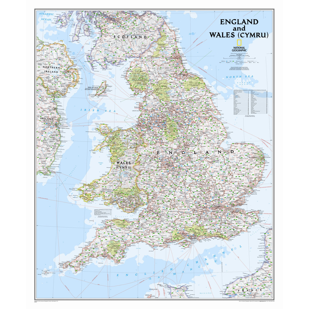
England and Wales Classic Wall Map,36" x 30" National Geographic Maps
Rated 5.0 out of 5 stars. 4 total votes
A detailed 36" x 30" map of England and Wales, printed on premium paper in traditional blue.
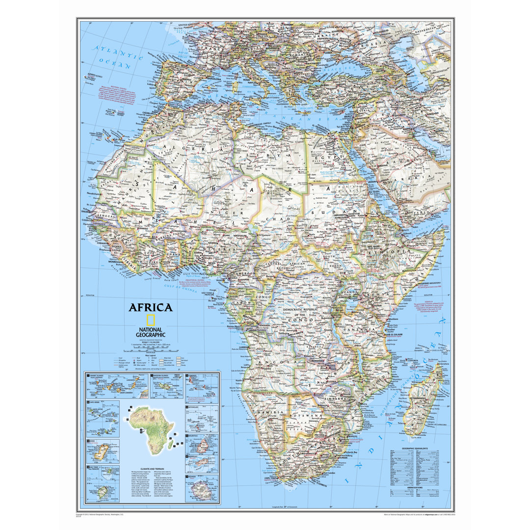
Africa Classic Wall Map National Geographic Maps Map
Rated 5.0 out of 5 stars. 4 total votes
An enlarged, traditional blue political map of Africa on paper, measuring 46" x 36".
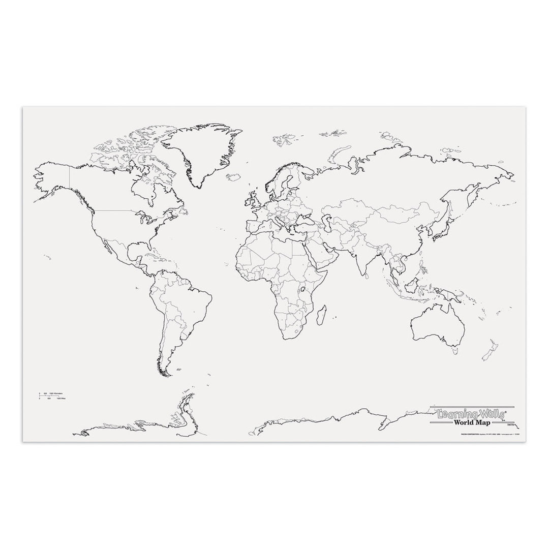
Giant World Map Pacon Corporation
Rated 5.0 out of 5 stars. 3 total votes
A large interactive paper world map for creative learning in science, history, and social studies.
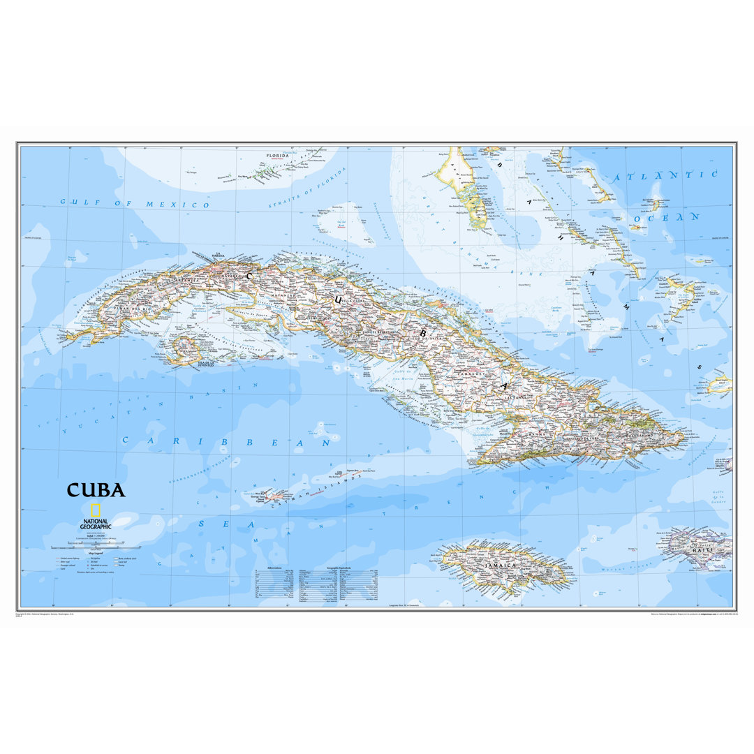
Cuba Classic Wall Map National Geographic Maps
Rated 5.0 out of 5 stars. 3 total votes
A detailed 24"x36" paper map of Cuba featuring vibrant colors and extensive geographical information.
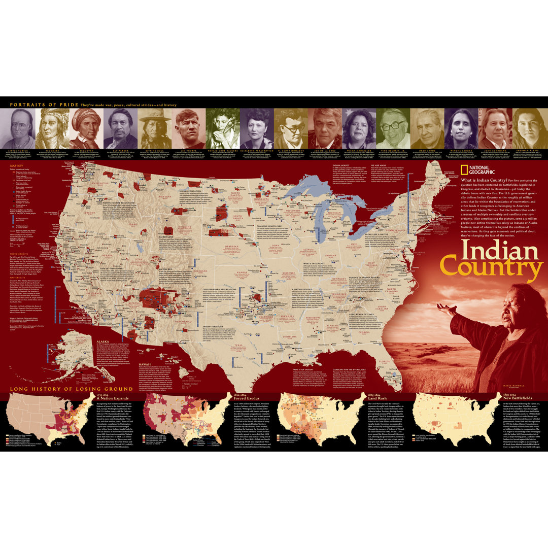
Indian Country Poster Map National Geographic Maps Map
Rated 5.0 out of 5 stars. 2 total votes
A detailed paper map showcasing Indian reservations, tribal entities, and historical land changes.
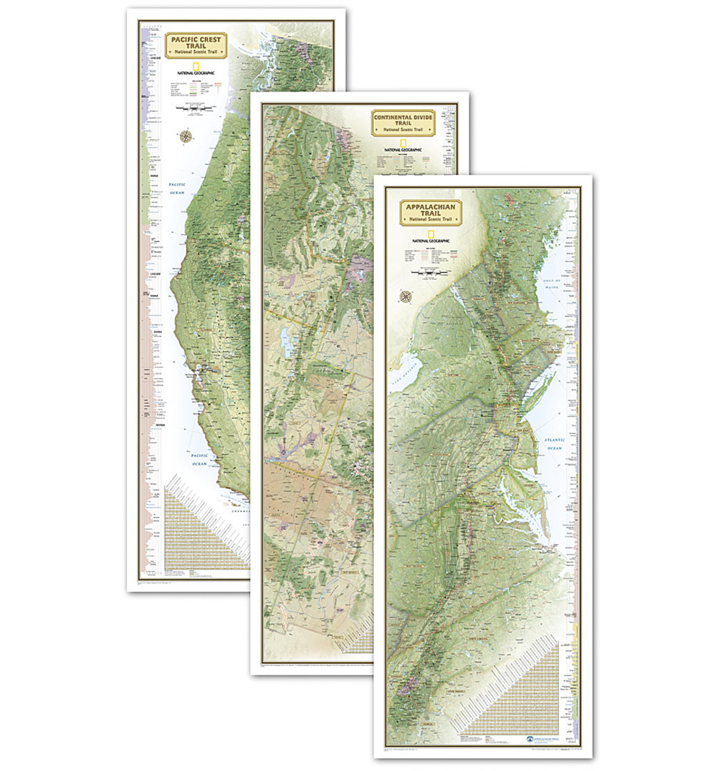
Triple Crown of Hiking - In gift box National Geographic Maps
Rated 3.0 out of 5 stars. 2 total votes
A multicolor paper map set featuring iconic U.S. trails, packaged in a decorative gift box.
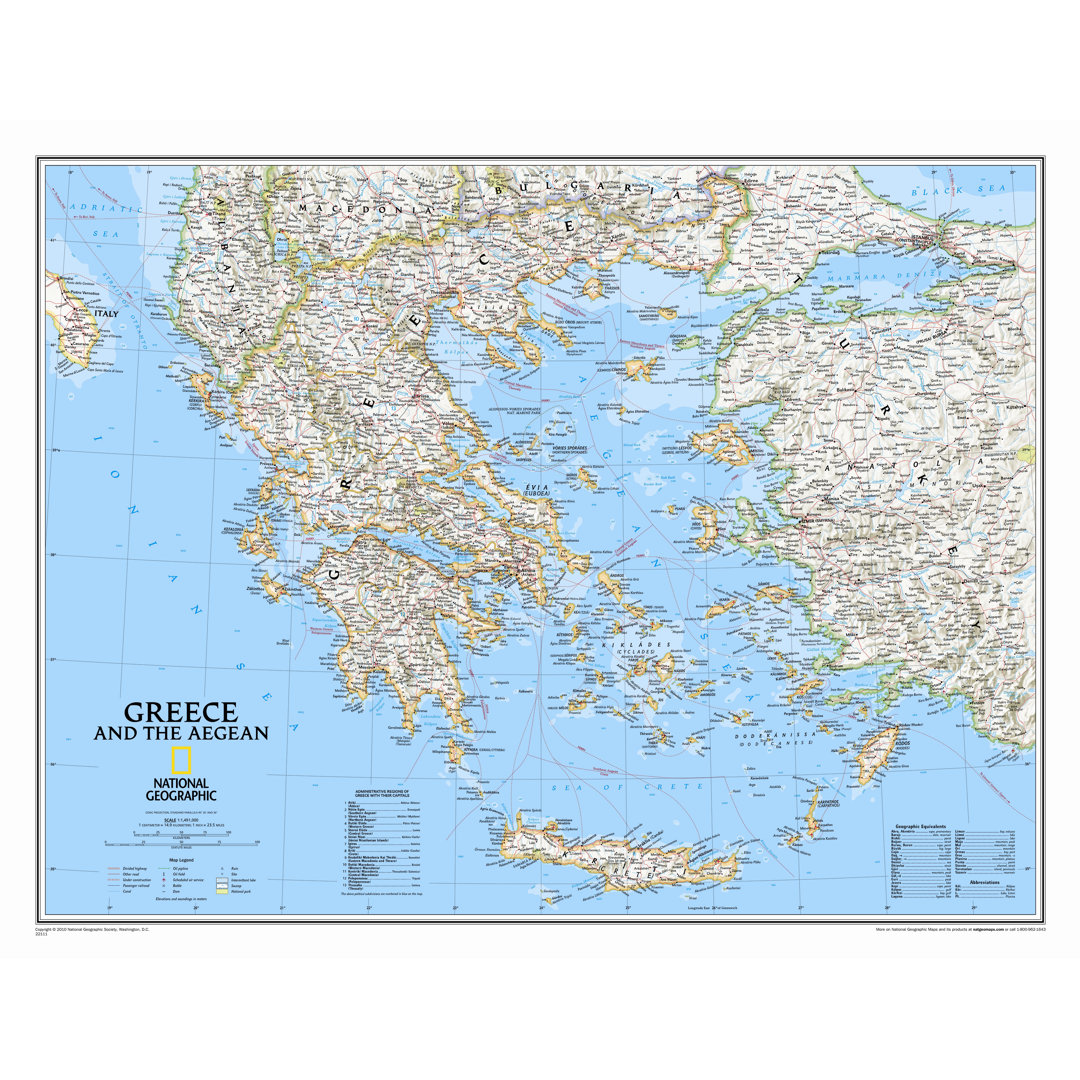
Greece Classic Wall Map National Geographic Maps Map
Rated 5.0 out of 5 stars. 2 total votes
A detailed paper wall map of Greece featuring political boundaries and geographic details, sized 24'' x 30''.
World Classic Pacific Centered Enlarged Wall Map National Geographic Maps
Rated 5.0 out of 5 stars. 2 total votes
A Pacific-centered wall map highlighting Oceania and Asia with classic cartography on paper.
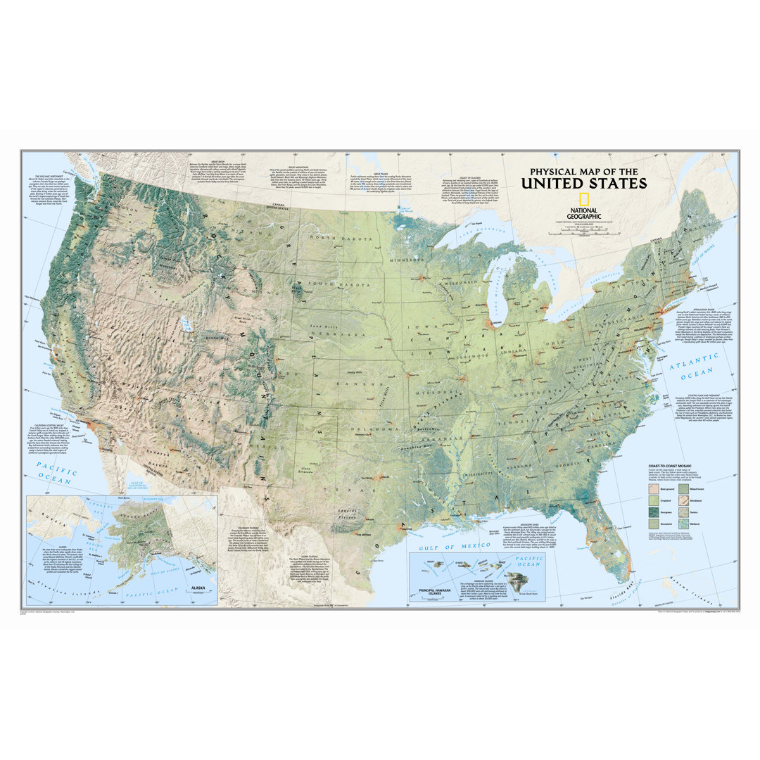
United States Physical Wall Map National Geographic Maps
Rated 5.0 out of 5 stars. 2 total votes
A beige paper map showcasing US topography and natural vegetation, ideal for educational travel reference.
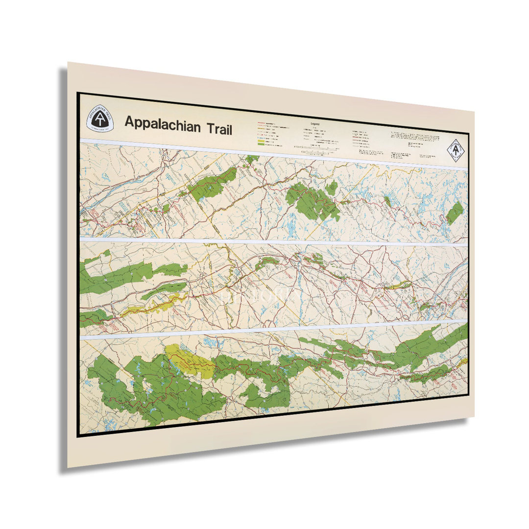
" 1981 Map Of The Appalachian Trail " HISTORIC PRINTS Overall
Rated 5.0 out of 5 stars. 2 total votes
A vintage-style paper print showcasing the detailed 1981 Appalachian Trail map, sized 24" x 36".
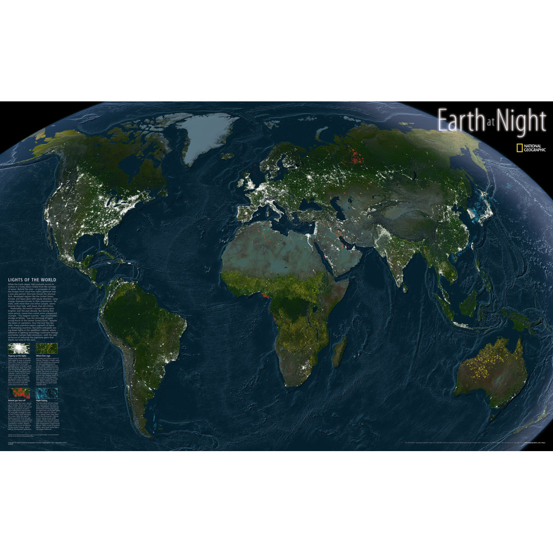
Earth at Night Map National Geographic Maps
Rated 5.0 out of 5 stars. 1 total votes
A detailed paper map showcasing Earth's night lights, fires, and fishing spots, sized 22" x 35".
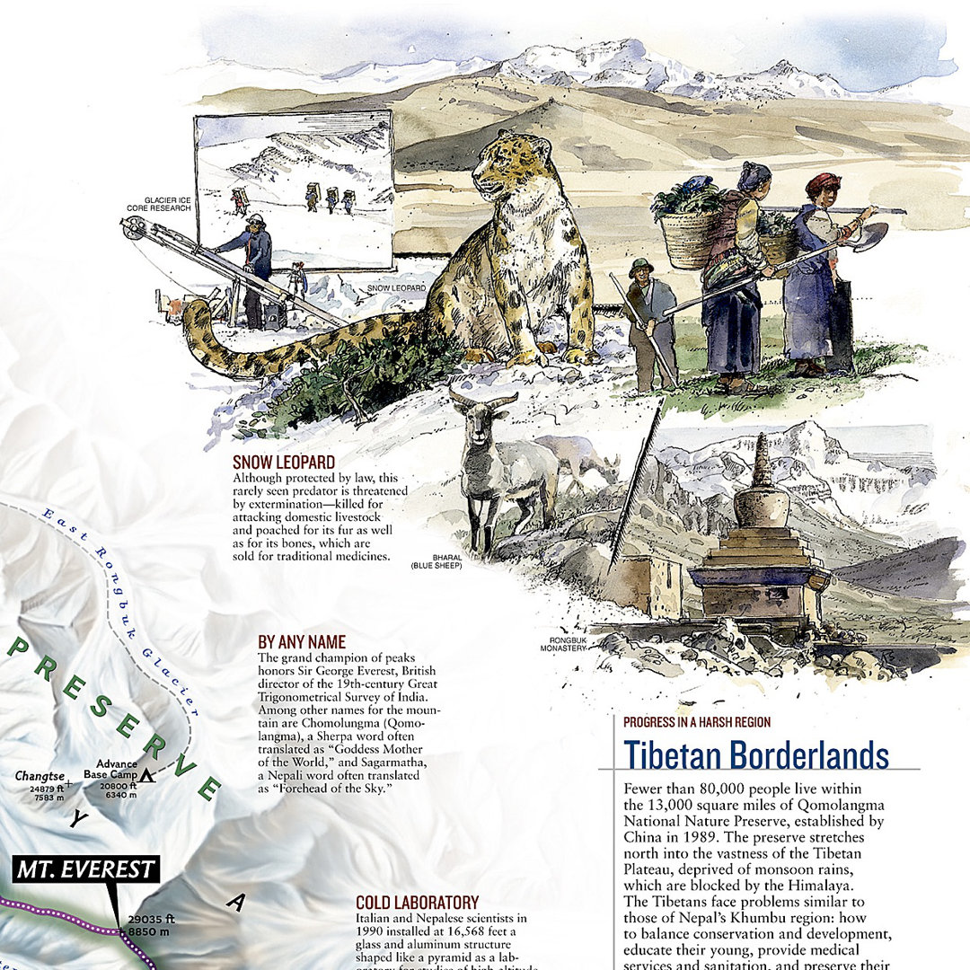
Mount Everest 50th Anniversary Wall Map (Two sided) National Geographic Maps Map
Rated 5.0 out of 5 stars. 1 total votes
A double-sided paper map showcasing Mount Everest's geography and expedition routes in white, beige, and blue.
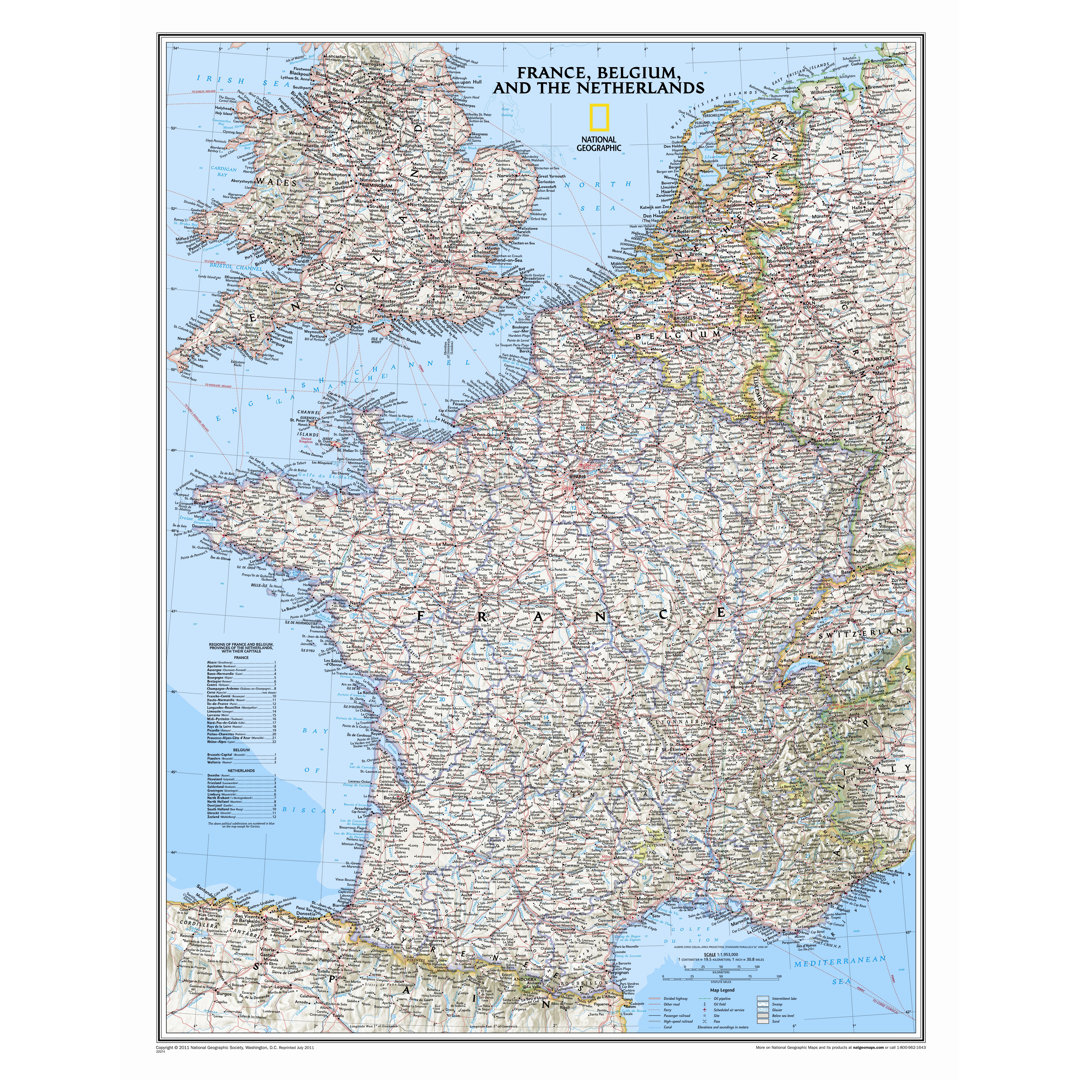
France, Belgium, and The Netherlands Classic Wall Map National Geographic Maps Map
Rated 5.0 out of 5 stars. 1 total votes
A detailed paper wall map showcasing France, Belgium, and the Netherlands with political and geographic features.
United States Physical Wall Map National Geographic Maps Map
Rated 5.0 out of 5 stars. 1 total votes
A detailed 25" x 38" paper map showcasing US topography and natural vegetation in traditional blue.
Paper Maps
Products Related to "Paper Maps"
-
")
World Classic Wall Map National Geographic Maps Map Type: Standard (30" x 44")
Enjoy the accuracy and beauty of the latest world map from the cartographers at National Geographic. This map features the Winkel Tripel projection to reduce distortion of land masses as they near the poles. Features include subtle border coloring on land, and prevailing winds and ocean currents at sea. Separate insets show the North and South Polar Regions, world vegetation and land use, and world population density. National Geographic Maps Map Type: Standard (30" x 44")
-

Round World 51'' W x 38'' H Dry Erase And Laminated World Map Round World
The hemisphere's world map is laminated. This best seller contains great detail with country capitals and populations. Round World
-

Caribbean Classic - Tubed National Geographic Maps Finish: Laminated
One of the most authoritative maps for the islands of the Caribbean Sea. It shows the entire region in great detail, with coverage extending from the tip of Florida to the northern extents of Colombia and Venezuela, east to Barbados, and west to the eastern edge of Honduras, Costa Rica, and Nicaragua. Detailed bathymetry reveals the remarkable seafloor variation of the Caribbean including the Puerto Rico Trench, the deepest point in the Atlantic Ocean at 8,605 meters (28,232 feet). Includes over 1,000 named places including country capitals, primary and secondary towns; political boundaries, important infrastructure, and all key landforms. Useful and informative notes about the region's history and unique geography are spread throughout the map, providing the reader further understanding of the Caribbean's unique attributes. The map is packaged in a two inch diameter tube with a label showing a thumbnail of the map with dimensions and other pertinent information. National Geographic Maps Finish: Laminated
-

North America Classic Wall Map National Geographic Maps Color: Traditional Blue
The political map of North America features trademark National Geographic detail and accuracy. The map shows country boundaries, place names, major highways and roads, bodies of water, and more. An inset map shows the Aleutian Islands off the coast of Alaska. National Geographic Maps Material: Standard Size Paper (30"H x 24"W), Color: Traditional Blue