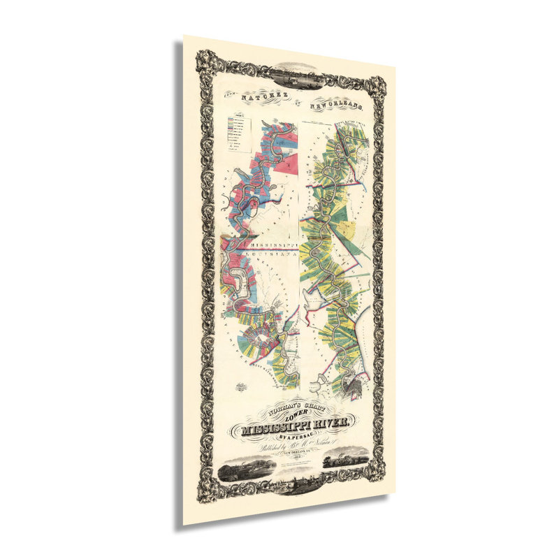
Illustrated by noted French-born fine artist and cartographer Marie Adrien Persac, this stunning depiction of the lower Mississippi River shows it in a period of significant growth and transformation in the years before the outbreak of the American Civil War. Persac moved to New Orleans in 1859 and remained throughout the war completing more than forty illustrations of notable buildings and geographic features found throughout the iconic city. His works bear a distinctive style that historians immediately recognize and value for their accuracy and information about New Orleans during the nineteenth century. This map was published by noted American book dealer Benjamin Moore Norman. Norma relocated from New York to New Orleans in 1837, which would remain his home until his death in 1860. The lower portion of the Mississippi River is a complex system of tributaries that release into the Gulf of Mexico. It has been an essential part of national and international shipping for centuries, and New Orleans' unique culture has been shaped by the mixture of French, Creole, and International residents. The river allowed the imported goods to flow into the Midwest part of the United States while exports traveled down the river before being shipped internationally. By 1858 the region had become one of the world's largest ports and was responsible for nearly doubling the population of New Orleans. This is an authentic piece of American cartographical history that immediately transports the viewer back in time, creating an indelible bond between past and present. Our museum quality giclee print comes printed with archival ink on premium heavyweight matte paper. Shipped in a sturdy cardboard tube your print will arrive ready to be framed. This eye-catching vintage map reproduction print makes the perfect gift for anyone that loves history and imagery.


 or
or