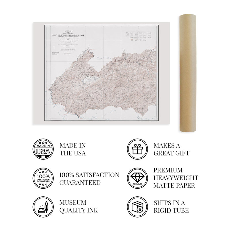
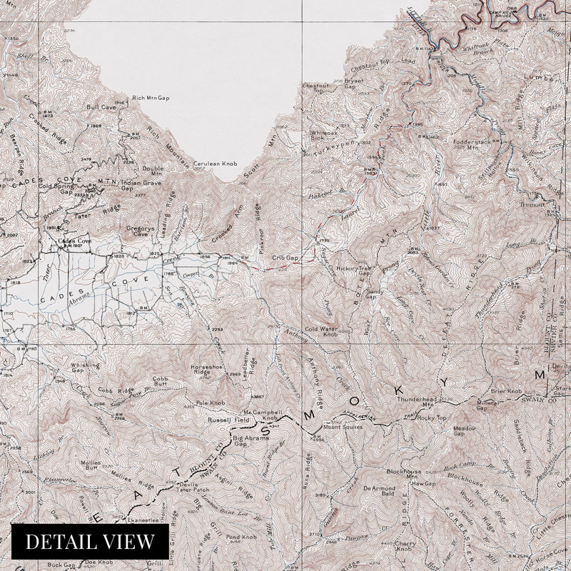
Established in 1934, the Great Smoky Mountain National Park remains one of the most iconic natural spaces in the country. As a subrange of the Appalachian Mountains, the Great Smokies receive more than eleven million visitors annually. This depiction of the park's Western elevations shows the portion primarily contained in Tennessee, where residents of Gatlinburg have been settled since the earliest dates and often lay claim as the original residents.The US Geological Services began producing topographical maps in 1884, and their distinctive aesthetic is immediately recognizable. By the 1970s, these maps had mainly been replaced by early satellite imagery and aerial photography, which makes these productions unique for their era. Advances in cartographical technology allowed maps produced during these times to bear incredible detail. The region's unique geography was not conducive to large-scale agricultural operations. It remained primarily rural and reliant on tourism-based economies even during this map's publication. Efforts have been made to preserve historical and archaeologically significant sites within the forest dating back to early European settlement. Additionally, Knoxville lays claim as the gateway to the Smokies on the Western portion, while Asheville stakes a similar claim in the East.The Smokies are known for their iconic low cloud cover that gives the hills the appearance of being covered in smoke and remains a national treasure. The classic style, geographical significance, and unique intersection of eras of this work make it a distinctive piece of Southern United States and Appalachian cartographical history.Our museum quality giclee print comes printed with archival ink on premium heavyweight matte paper. This eye-catching vintage map reproduction print makes the perfect gift for anyone that loves history and imagery.
 or
or