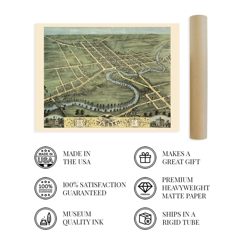
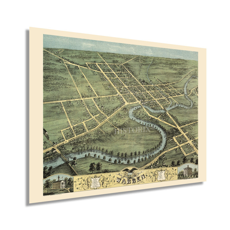
Produced and published by one of the pioneers of the birds eye perspective form, Albert Ruger, this stunning depiction of Warren, Ohio, illustrates the city in a period of significant transformation and growth in the years following the conclusion of the American Civil War. Initially founded in 1798, Warren was experiencing considerable prosperity in the later portions of the nineteenth century as a manufacturing and trading hub for Northeast Ohio. The city was the first to install electric street illumination and became a major steel producer during the Industrial Revolution. Panoramic maps were widely popular during the mid-nineteenth century until the 1920s, when advances in aviation and photography allowed aerial photography to become the norm. The unique aesthetic and distinctive style of birds-eye perspectives immediately transport the viewer back in time, creating an indelible bond between the past and present. Ruger was instrumental in popularizing perspective maps which served as marketing materials to promote prominent civic features, religious, cultural, and educational institutions, as well as other economic opportunities to attract residents and merchants alike. Warren’s location on the Mahoning River allowed for the establishment of mills and factories during the nineteenth century and by 1870 had become a regional attraction.This is an authentic piece of American cartographical history that captures Warren’s rich history. The city has come to be known as the Historic Capital of the Western Reserve, and as the seat of Trumbull County, Warren remains a cultural and economic center for the surrounding areas.Our museum quality giclee print comes printed with archival ink on premium heavyweight matte paper. Shipped in a sturdy cardboard tube your print will arrive ready to be framed. This eye-catching vintage map reproduction print makes the perfect gift for anyone that loves history and imagery.
 or
or