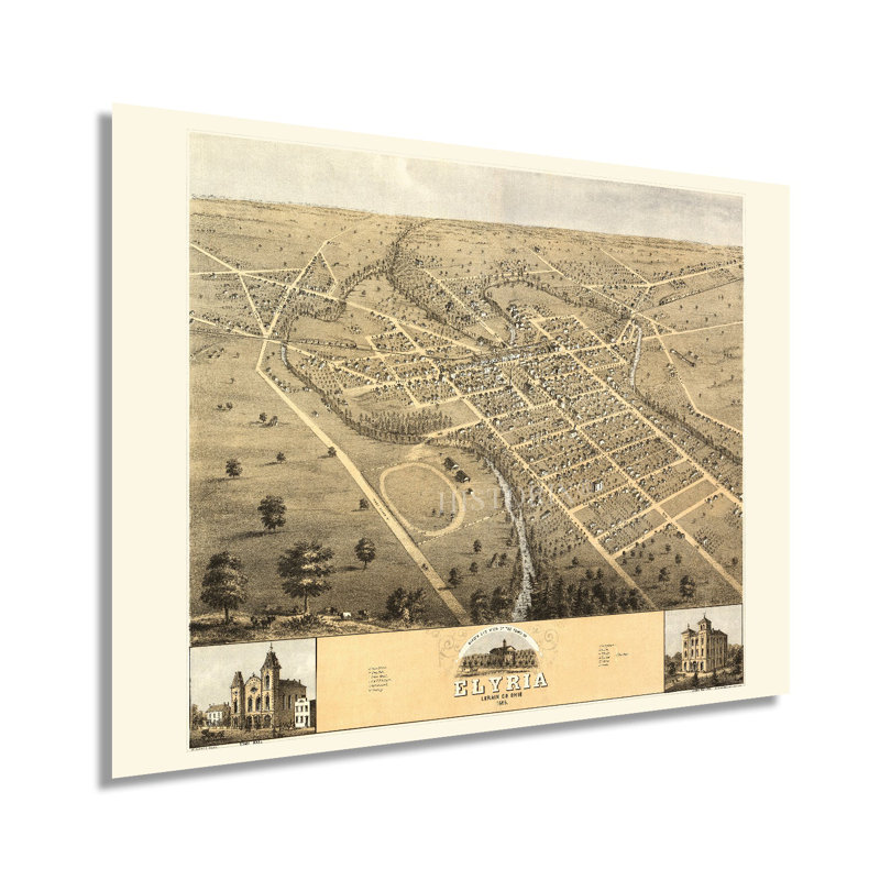
Founded in 1817 and now part of the greater Cleveland Metropolitan area, Elyria is situated on the forks of the Black River and, by 1868, had experienced significant economic and cultural growth. The town featured numerous mills which attracted Western European immigrants who established neighborhoods and communities based on cultural lines, many of which exist to this day. Following the conclusion of the American Civil War, Elyria had experienced another period of growth; as the nation began efforts to rebuild and demand for goods increased, many towns and cities found their factories operating at unprecedented levels.This birds eye perspective was produced by Albert Ruger, an early pioneer of the form, and is one of the earlier publications done in this style. Panoramic maps were used as marketing materials to attract residents and merchants alike and featured prominent civic buildings and economic opportunities. The thriving manufacturing industry was leading to significant prosperity as the Industrial Revolution saw factories and plants attracting workers from agricultural regions to urban centers eager for work. This would continue until the turn of the twentieth century, when Elyria’s population would grow past eight thousand.This is an authentic work of nineteenth-century cartographical history with a unique aesthetic and classic design that immediately transports the viewer back in time. It captures Elyria in a period of significant transformation as the United States became more modern and advances in construction and technology transformed daily life. Ruger would go on to produce numerous panoramic maps across America.Our museum quality giclee print comes printed with archival ink on premium heavyweight matte paper. This eye-catching vintage map reproduction print makes the perfect gift for anyone that loves history and imagery.
 or
or