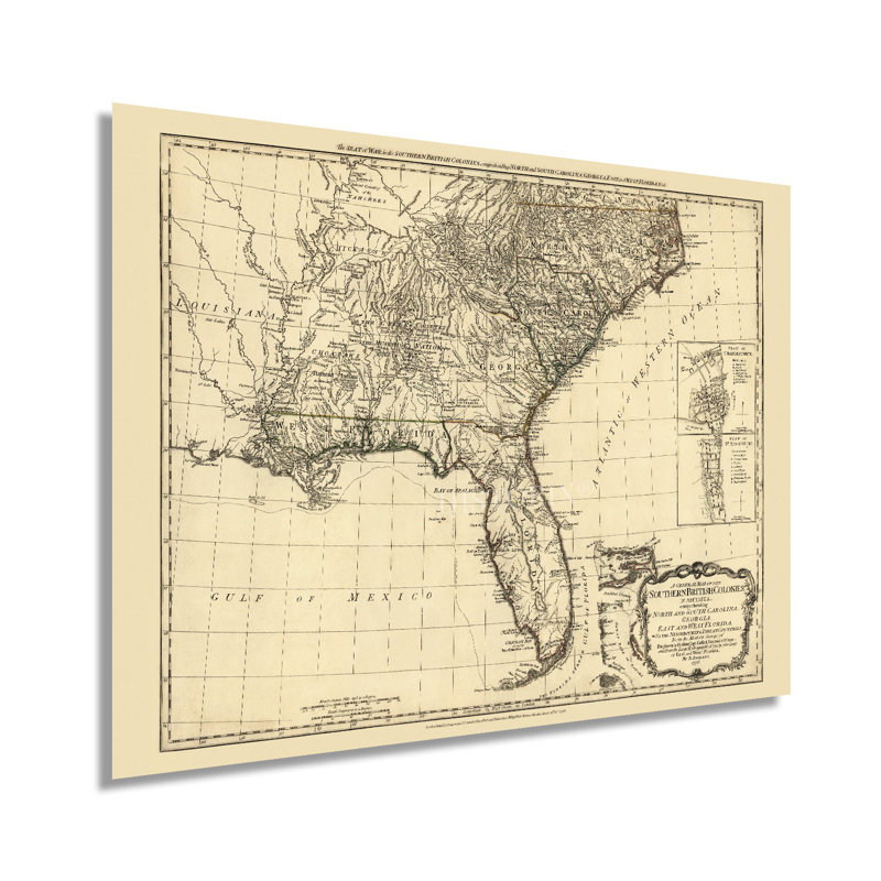
The distinguished illustration style and ornate details of this production by Dutch-born cartographer and navigator Bernard Romans captures the Southern British Colonies in the same years as the passage of the Declaration of Independence. Romans’ map and charts are considered the best of the era, and his most noted work, A Concise Natural History of East and West Florida, was published the previous year. He emigrated to the British Colonies in 1757 to fight in the Seven Years War and became a strong voice in the push for Colonial Independence in the late eighteenth century. The Southern colonies had provided a large number of agricultural products for export to England and the Caribbean and remained a crucial economic driver for the Crown. As the American Revolution broke out, the critical port at Charleston came under siege and fell to British Forces in 1780. This was a significant victory as the British military shifted its focus from the stalemate in the Northern Colonies and tried to gain a stronghold in the Southern theater. Revolutionary forces led by Nathaniel Greene, Thomas Sumter, and Francis Marion eventually succeeded in pushing General Cornwallis’ troops to Virginia, leading to their surrender at Yorktown in 1781.This map has a distinctive style and classic aesthetic that makes it immediately recognizable and transports the viewer back in time, creating an indelible bond between the past and prsent. Due to his technical prowess and ability to accurately detail land and nautical features, Gallatin’s production endures in American History.Our museum quality giclee print comes printed with archival ink on premium heavyweight matte paper. Shipped in a sturdy cardboard tube your print will arrive ready to be framed. This eye-catching vintage map reproduction print makes the perfect gift for anyone that loves history and imagery.
 or
or