

$62.99 was$67.99
{MONTHLY_PAYMENT}{SUBTITLE_TEXT}with or
or
or
Earn 5% back¹ in rewards, plus more exclusive perks
Size:
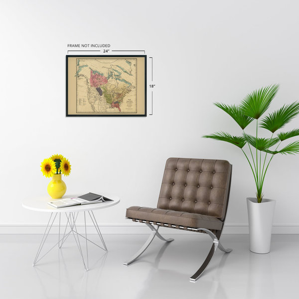
18" W x 24" H
FREE Delivery
Get it Sat, May 23 - Wed, May 27
to
43215
8 Left in Stock

At a Glance

Primary Art Material: Paper

Unframed
About This Product
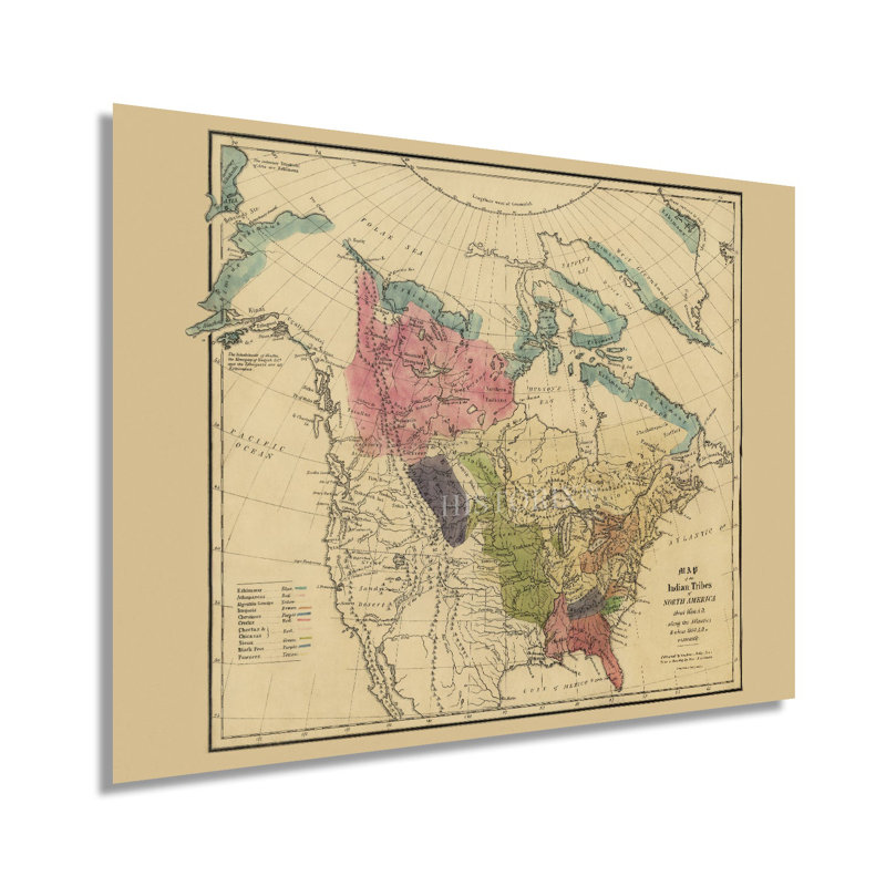
Produced by noted Swiss-American politician, diplomat, ethnologist, and linguist Albert Gallatin, this unique depiction of the indigenous tribes of North America in the seventeenth century bears a distinctive aesthetic and classic style. Gallatin is considered America’s Swiss Founding Father, and he established the iconic New York University. Gallatin’s work in cartography and politics helped shape the early portions of the United States. His illustrated map documenting the tribes of North America served to show the migration and cultural traditions from the 1600s on. While the Atlantic Coast had been well established, Lewis & Clark’s expedition to the Pacific Northwest had illuminated other tribes and peoples across the vast Western portion of the United States.Gallatin uses distinct colors to show tribal lands, cultural boundaries and also illustrates geographic features across the Atlantic seaboard. The rich tribal history of the Eastern United States was well documented during the nineteenth century as treaties, and land negotiations between settlers and native peoples caused a shift in demographics across America. Gallatin’s production is well regarded as a critical part of American cartographical history.Gallatin was integral to negotiating the Louisiana Purchase and was an ardent believer that control of the Port in New Orleans was crucial for westward expansion and promoting Manifest Destiny. He also believed in heavy investment in infrastructure like canals and roads to further connect the United States. This production is notable as it extends from the southern portions of Florida to the Arctic Circle and the Hudson Bay.Our museum quality giclee print comes printed with archival ink on premium heavyweight matte paper. Shipped in a sturdy cardboard tube your print will arrive ready to be framed. This eye-catching vintage map reproduction print makes the perfect gift for anyone that loves history
Features
- VINTAGE MAP REPRODUCTION: You’ll love this high quality historic reproduction of 1836 Indian Tribes of North America Map. Our museum quality prints are archival grade, which means it will look great and last without fading for over 100 years. Our print to order maps are made in the USA and each map is inspected for quality. This beautiful artwork is a perfect addition to your themed decor. Vintage maps look great in the home, study or office. They make a perfect gift as well.
- MUSEUM QUALITY: This high quality map print will be a great addition to your vintage-themed wall. Don't waste money on cheap-looking, thin paper posters. We use thick, fine art print quality matte paper. Our professional’s choice matte paper displays artwork in high detail without glare. The color is vibrant and text is easy to read. When framed, this map looks absolutely stunning.
- A LOOK BACK AT HISTORY: This is an impressive, historic reproduction of 1836 Native American History Map. A true piece of history. See our product description section for more fascinating information about this historic map and its significance.
- READY TO FRAME: This print includes a 0.2 inch border for a perfect frame fit and look. Our maps are designed to fit easy-to-find standard frame sizes, saving you money from having to pay for a custom frame. Each map is inspected for quality and shipped in a rigid tube.
- HISTORIX: We love history and art. Sometimes old maps have tears, folds, separations and other blemishes. We digitally restore and enhance maps while keeping its historical character. All our maps are proudly made in the USA. Customers all over the world love our vintage maps and we know you will too.