
$62.99 was$67.99
{MONTHLY_PAYMENT}{SUBTITLE_TEXT}with or
or
or
Earn 5% back¹ in rewards, plus more exclusive perks
Size:
18" W x 24" H
FREE Delivery
Get it Sat, May 23 - Wed, May 27
to
43215
8 Left in Stock

At a Glance

Primary Art Material: Paper

Unframed
About This Product
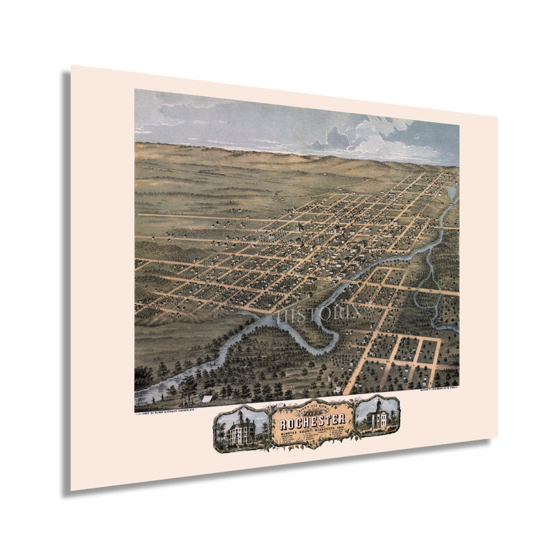
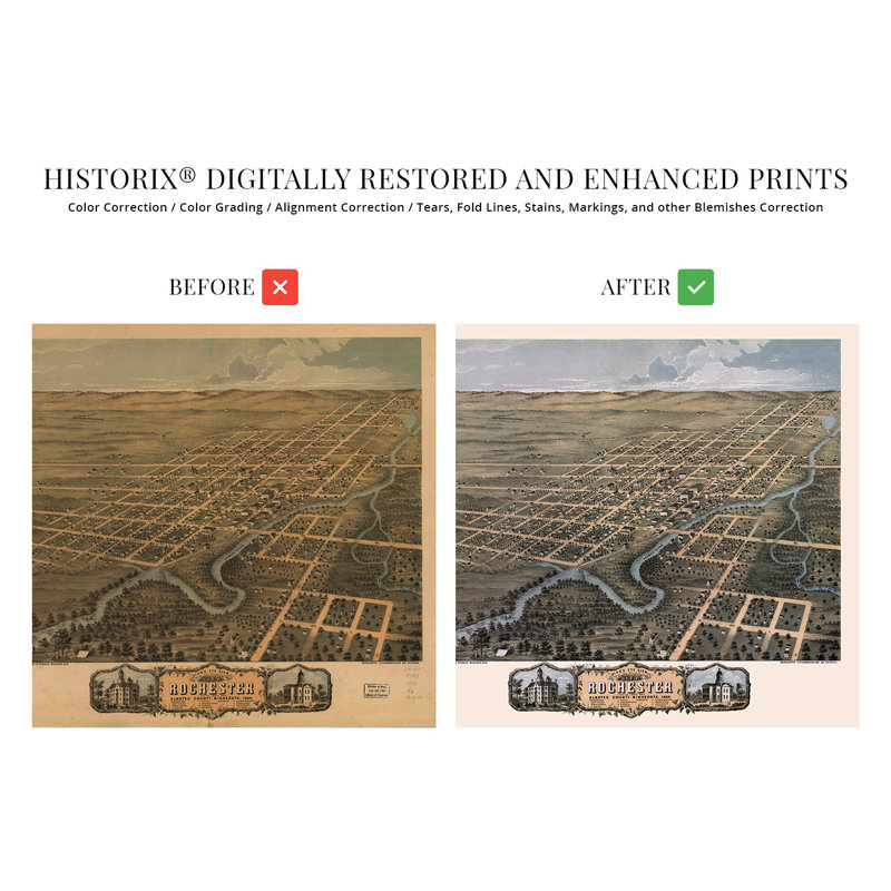
Produced and published by one of the most prolific American cartographers of the nineteenth century, Albert Ruger, this stunning depiction of Rochester, Minnesota, shows the city in a period of significant growth and transformation following the completion of the Winona and St. Peter Railroad in 1864. Initially, the town served as a stagecoach stop for settlers heading to Saint Paul. However, its location on the South fork of the Zumbro River allowed it to develop as an economic center in its own right attracting immigrants from across Eastern and Western Europe who established neighborhoods and communities along cultural lines, many of which exist to this day. Birdseye perspectives were produced as marketing materials to attract merchants and residents alike and featured prominent civic buildings, religious and educational institutions, as well as other economic opportunities and geographic enticements. Rochester is home to the Mayo Clinic, which established the city as a center for medical treatment and advances that contributed significantly to the city’s growth. Doctor William Mayo first established the clinic only five years before the publication of this map. Minnesota’s extensive lands attracted many Scandinavian settlers who established farms, ranches, and dairies in the areas surrounding cultural centers like Rochester.This is an authentic piece of American cartographical history with a unique style and distinctive aesthetic that immediately transports the viewer back in time, creating an indelible bond between the past and present. The years following the Civil War saw a marked large population growth in Northern states.Our museum quality giclee print comes printed with archival ink on premium heavyweight matte paper. Shipped in a sturdy cardboard tube your print will arrive ready to be framed. This eye-catching vintage map reproduction print makes the perfect gift for anyone that loves history and imagery.
Features
- VINTAGE MAP REPRODUCTION: You’ll love this high quality historic reproduction of 1869 Rochester Minnesota Map Poster. Our museum quality prints are archival grade, which means it will look great and last without fading for over 100 years. Our print to order maps are made in the USA and each map is inspected for quality. This beautiful artwork is a perfect addition to your themed decor. Vintage maps look great in the home, study or office. They make a perfect gift as well.
- A LOOK BACK AT HISTORY: This is an impressive, historic reproduction of 1869 Rochester Wall Map of Minnesota. A true piece of history. See our product description section for more fascinating information about this historic map and its significance.


