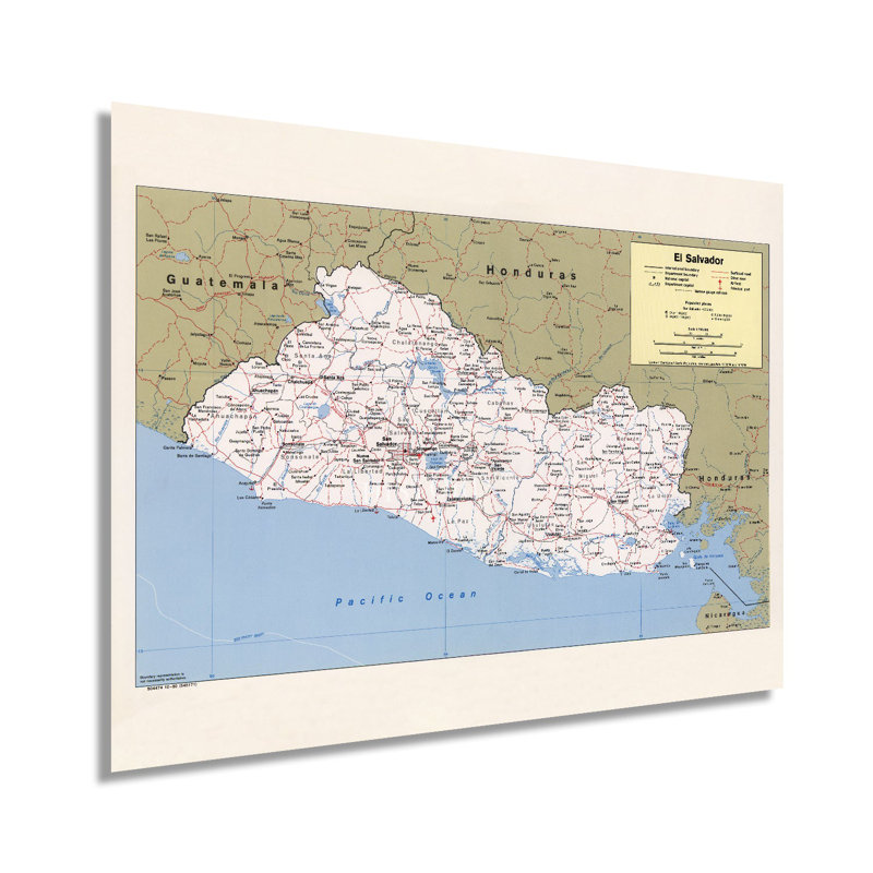
Produced during a time of significant growth, transformation, and evolution, this Central Intelligence Agency-produced map shows El Salvador in a critical period of its rich history. In 1979 a coup had installed a military Junta that privatized many companies and seized privately owned land. Resistance grew to the government, and numerous guerrilla sects were formed to attempt to dismantle government control. The Salvadoran Civil War broke out in 1980 following the assassination of Catholic Priest Oscar Romero. It would last until January 16, 1992, when President Alfredo Cristiani brokered peace with the aid of the United Nations. The CIA produces geopolitical maps for every region to maintain current borders and provide government and military officials accurate information regarding geopolitical boundaries. These maps represent some of the most accurate depictions in existence and are frequently used for reference by those in academia and business. CIA maps are considered the vanguard for accurate depictions and representations of borders and shifting boundaries. Their unique style and minimal aesthetic immediately transport the viewer back in time, creating an indelible bond between the past and present.Bordered by Guatemala to the north and Honduras to the east, El Salvador boasts a diverse climate ranging from dense jungles to vast coastlines and beaches. Though the 1980s were a turbulent time for the nation, the following decades saw relative peace return to the region and economic expansion as foreign investment and improvements in infrastructure increased the agricultural and tourism economies as well as mining and exporting.Our museum quality giclee print comes printed with archival ink on premium heavyweight matte paper.This eye-catching vintage map reproduction print makes the perfect gift for anyone that loves history and imagery.


 or