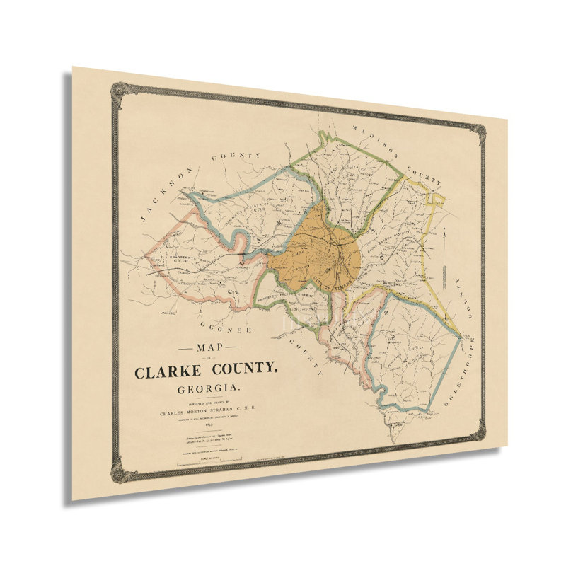
Originally surveyed and illustrated by professor Charles Morton Strahan, the iconic mapmakers Rand McNally released this as an independent map in 1898. The original depiction was released in a book published by Strahan that detailed local residents, scholarly institutions, and regional features. One of the most iconic cities of the American South, Athens, is the county seat and home to the University of Georgia. Clarke County was established in 1801 by the Georgia General Assembly and was named after Revolutionary War hero Elijah Clarke. The Daughters of the American Revolution sponsored and erected a monument to Clarke on Broad Street in downtown Athens. The minimal aesthetic and distinctive style immediately transport the viewer back in time and create an indelible bond between the past and present. Rand McNally released their first map in 1872 and would go on to become synonymous with American cartography and transportation during the transformation from rail to automobile. Rand McNally was responsible for the numbered highway system, which they incorporated into their productions and even built signs for, which led to federal adoption of the system. The company would expand its publishing operations to include non-fiction, textbooks, travel guides, and atlases. By the late nineteenth century, Clarke County had a thriving regional economy based on milling, textile manufacturing and was experiencing expansion as railroads increased access throughout the state. Located some seventy miles northeast of Atlanta, Clarke County is in the Piedmont region of Georgia between the Atlantic basin and the Appalachian Mountains. Our museum quality giclee print comes printed with archival ink on premium heavyweight matte paper. Shipped in a sturdy cardboard tube your print will arrive ready to be framed. This eye-catching vintage map reproduction print makes the perfect gift for anyone that loves history and imagery.
 or
or