- Fast Delivery
to:
Filter By Category
Filter By Price
Filter By Customer Rating
Filter By Color






The Wall Maps History & Nature Collection
5 Items
Get it by Fri, Oct 2
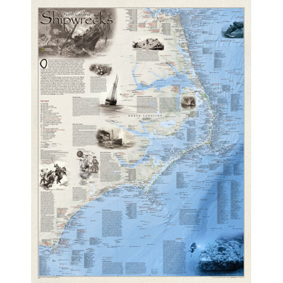
Shipwrecks of the Outer Banks is a stunning map illustrating more than 1,550 shipwrecks of the Atlantic Coast from Cape Henry, Virginia to Cape Fear, North Carolina. The shipwrecks are clearly marked atop beautiful bathymetric and coastal detail. Each wreck site is symbolized to define the class, type and name of vessel accompanied by the date of sinking. Icons also indicate whether a ship was lost due to conflict or natural causes. Locations of lifesaving stations and lighthouses, along with navigational beacons are also marked. Bathymetric and coastal features are clearly labeled. Captions and drawings are used to highlight unique historical events. Whether a naval buff, educator, amateur historian, mariner or someone simply enamored with the captivating power of the sea, Shipwrecks of the Outer Banks would make a great gift or a perfect addition to your map collection. Net proceeds from the sale of this map go to support the nonprofit mission of the National Geographic Society.
This is the best map of those shipwrecks in the Graveyard of the Atlantic. I've had it frames for my office!. Sandy. Belton, MO. Sat Mar 16 2024
Get it by Fri, Oct 2
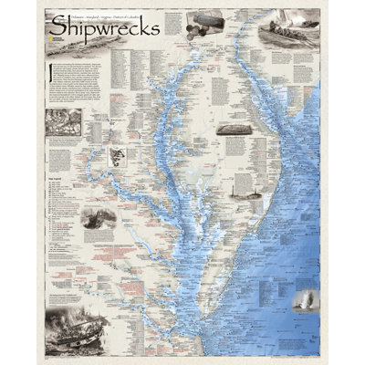
Developed by renowned marine archaeologist and accomplished author Don Shomette, and designed by award-winning cartographer Robert Pratt, Shipwrecks of Delmarva is a stunning cartographic piece based on years of research and expert visual design. Shipwrecks of the Delmarva shows the location of over 2,400 wrecks from the waters off the Delaware coast to the waters of the Chesapeake Bay, displayed atop beautiful bathymetric and coastal detail. Each wreck site is symbolized to define the class, type, and name of vessel accompanied by their dates of sinking. Locations of lifesaving stations, lighthouses and lightships, along with navigational beacons are accurately marked. Bathymetric and coastal features are clearly labeled, accompanied by inset maps, captions, and drawings used to highlight unique historical events such as the sinking of the U.S.S. Cumberland, the German U-Boat offensives, and the ghost fleet of Mallows Bay the largest assemblage of wooden ships in the Western Hemisphere. Wrecks featured on this map span from the mid-1600s galleons to 20th-century naval ships, those lost in military conflict, foul weather, bloody mutinies, pirate raids, human error, treacherous shoals, and a myriad of other events. Whether a naval buff, educator, amateur historian, mariner, or someone simply enamored with the captivating power of the sea Shipwrecks of Delmarva makes a perfect addition to your map collection as well as wonderful gift.
My son collects shipwreck maps this was perfect for his collection. Shannon. Mahanoy City, PA. Wed Jun 27 2018
Get it by Fri, Oct 2
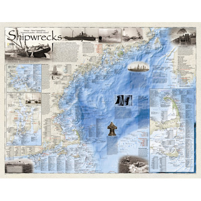
Developed by renowned marine archaeologist and accomplished author Don Shomette and designed by award-winning cartographer Robert Pratt, Shipwrecks of the Northeast is a stunning new map illustrating more than 5,400 known shipwrecks on the untamed Atlantic coast of New England (Maine, Massachusetts, New Hampshire and Rhode Island). From Rhode Island's Narragansett Bay to Maine's St. Croix River, the shipwrecks are clearly marked atop beautiful bathymetric and coastal detail. Each wreck site is symbolized to define the class, type and name of vessel accompanied by the date of sinking. Icons also indicate whether a ship was lost due to conflict or natural causes. Locations of lifesaving stations and lighthouses, along with navigational beacons are also marked. Bathymetric and coastal features are clearly labeled, accompanied by inset maps for Nantucket Sound, Cape Cod Bay, and Martha's Vineyard, Rhode Island's Narragansett Bay and the Boston Harbor Islands. Captions and drawings are used to highlight unique historical events such as the infamous sinking of the Italian luxury liner Andrea Dorian on July 25, 1956 when it collided with the M/V Stockholm in the fog off Nantucket. The first fully authenticated pirate ship Whydah is also highlighted in the Pirates of New England section of the map. Wrecks featured on this map span from mid-1600s galleons to 20th-century naval ships, those lost in military conflict, foul weather, mutinies, unseen rocks, treacherous shoals, mechanical failures and a myriad of other events. Whether a naval buff, educator, amateur historian, mariner or someone simply enamored with the captivating power of the sea Shipwrecks of the Northeast would make a great gift or a perfect addition to your map collection. Specifications Map measures 28 x36 (landscape orientation) Map scale: 1:723,000 Transverse Mercator Projection Copyright 2. Related Products " Shipwrecks of the Delmarva wall map " Ghost Fleets of the Outer Banks wall map " Battles of the Civil War wall map About the Authors Robert E. Pratt " (Design and Production) Bob is a 28 year award winning veteran of countless NGS map products which include magazine page maps and supplements, wall maps and atlas maps. In addition, he has done work for organizations such as: The Conservation International, The Wilderness Society, Wildlife Management Institute, The U.S. Naval Academy, The Baltimore Museum of Industry, The Mariners Museum, Maryland Historical Society. Donald G. Shomette " (Text and Ships Information) Don has worked with the U.S. Navy in providing the largest federal historic shipwreck inventory to date and has surveyed some of the oldest shipwreck fleets along the Atlantic coast. A well-known maritime archaeologist of Western Europe and the Western Hemisphere, he has been sponsored by the National Geographic Society and the National Park Service. Don has been the recipient of numerous honors, including the twice winner of the John Lyman Book Award for Best Maritime History.
Great quality map, very detailed and interesting. Perfect gift for someone who enjoys sailing, and has an appreciation for the beauty of the ocean.. Sylvie. Kennebunkport, ME. Sat Jan 18 2020
Get it by Fri, Oct 2
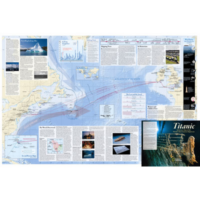
It is common knowledge that the giant ocean liner Titanic struck an iceberg and sank to the bottom of the Atlantic on the night of April 14-15, 1912. But where exactly did she sink? Could better maps have prevented the disaster? How was the wreck found? Time has raised even more questions. Where is ice most dangerous? What happened to the passengers and crew who survived? This double-sided, full-color info graphic (39 x 26 ) gives the details and shows: - Titanic's route; shipping lanes before and after the disaster; the journey of the fateful iceberg; charts and statistics from post-disaster hearings; inset map of ice and rescue ships; deep-ocean diagrams of the search process; Titanic points of interest. - Color-coded deck plans and cutaway view; passengers' profiles; ship size comparisons; the story in art and culture; plans for the wreck's future. National Geographic Explorer- in-Residence Robert Ballard discovered the wreck in 1985, and the National Geographic Society will be marking the 100th anniversary of the Titanic with a host of special events. Due to the mass-appeal of the Titanic's story, the anniversary date will be covered by a wide variety of media and retail programs in the U.S. and internationally.
I purchased for my son who is a big titanic fan I know he will enjoy. Anonymous. Sun Oct 11 2020

National Geographic's wall map is a reference map of National Parks of the United States which highlights the nearly 400 magnificent parks across America. The country is represented in subtle earth-tones with shaded mountain relief and intricately drawn river systems. Colorful photos capture some of the diverse landscapes preserved and protected by the national park system. Separate inset maps provide detail and descriptions of seven of the parks: Yellowstone, Yosemite, Acadia, Grand Canyon, Great Smoky Mountains, Everglades, and Zion. Parks located in U.S. territories are included on an inset world map. Net proceeds from the sale of this map go to support the non-profit mission of the National Geographic Society. Key
Christmas present for my son and he loves it! Again, great gift, fair price and fast shipping.. Lanette. Valrico, FL. Mon Jan 10 2022