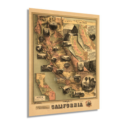
This map was published during a period of significant prosperity in California spurred by thriving ports, profitable mining operations, and vast agricultural production. The completion of the first transcontinental railroad in 1869 expanded access and caused another population boom as immigrants, and other Americans flocked to the region. As part of the Compromise of 1850, California became a free state and was admitted into the Union. During the American Civil War, California shipped gold east in support of Union troops though no military regiments engaged in combat during the conflict. San Francisco and Los Angeles were growing rapidly as their international ports exported numerous goods to thriving markets globally while importing exotic goods from Asia and South America.The Gold Rush during the middle portions of the nineteenth century had shaped the cultural and political landscape throughout the State and drawn eager immigrants from China and Japan, which established numerous communities along cultural lines, many of which exist to this day. This distinctive map bears a unique aesthetic and contains twenty vignettes that serve to promote the State's numerous natural features. Little is known of this map's illustrator, though Johnstone did also produce a climatic map of California published in the same year.Because this map was not produced for geographic reference, it served to attract residents and merchants alike, and it remains an important part of American cartographical history. The distinctive aesthetic immediately transports the viewer back in time, creating a remarkably indelible bond between the past and present.Our museum quality giclee print comes printed with archival ink on premium heavyweight matte paper. This eye-catching vintage map reproduction print makes the perfect gift for anyone that loves history and imagery.