Show Related CategoriesCategory

2 Sizes
By Williston Forge
24" H x 36" W
Rated 5 out of 5 stars.2 total votes
FREE Delivery
Produced by noted American architect, illustrator, and designer Courtland Smith, this detailed pictoral map of Long Island, shows the region in a period of significant transition. The Great Depression of the 1930s kept Smith’s architecture career from flourishing and resulted in his partnership with Richard Foster to produce pectoral maps throughout New York. His work is noted for its signature clean style and elegance. Following the conclusion of the Great Depression, Smith would go on to design the iconic Houston Astrodome in the 1960s and other notable works internationally. This map was first published in 1933 but has become one of the most popular depictions of Long Island due to its distinctive aesthetic and unique blend of art, history, and local features.Pictorial maps are distinguished by the numerous references that showcase civic and geographic features to attract merchants and residents alike. Pictoral maps were also displayed locally as a show of civic pride. From Montauk in the East to the borough of Queens in the West, including Staten Island, and features several landmarks including the Montauk Light, Southampton, and Coney Island. The ornate flourishes and art deco design further differentiate this piece from other works of the era.This is an authentic piece of American cartographical history that immediately transports the viewer back in time, creating an indelible bond between the past and present. Long Island was settled by numerous waves of immigration throughout the eighteenth and nineteenth centuries, becoming one of the most diverse regions in the United States.Our museum quality giclee print comes printed with archival ink on premium heavyweight matte paper. Shipped in a sturdy cardboard tube your print will arrive ready to be framed. This eye-catching vintage map reproduction print makes the perfect gift for anyone that loves history and imagery.
I moved from Long Island and wanted to remember my Roots. Frames it looks very expensive.. Marie. Medford, NY. Thu Sep 10 2026

2 Sizes
By Williston Forge
18" H x 24" W x 0.1" D
Rated 5 out of 5 stars.1 total vote
FREE Delivery
The Great Smoky Mountains are among the oldest in the world and a true American icon, evoking images of early American settlers and the rich cultural tapestry of Southern Appalachian history. Our enhanced, museum quality, giclee reproductions of the original 1940 Smoky Mountains map are the perfect representation of that history. The original 1940 map was created for the dedication of the park by President Franklin D. Roosevelt and serves as an iconic piece of park history. A distinctive aesthetic takes the viewer back in time, instilling an indelible bond between present and past, while our enhanced archival print transforms this rich history into a contemporary work. The famous Appalachian trail drives straight through the heart of the park and has been an international attraction for hikers since its completion in 1937. Some 2 million people attempt this through hike annually and when hikers' journey takes them through the Great Smoky National Park they find the highest elevation of the entire trail. The Museum level quality of this enhanced reproduction brings the piece to life and provides a real sense of connection to the history of the park and region. Printed on heavy matte stock and ready for framing this print is perfect as a gift for the hikers and history buffs in your life, or a unique addition to your own space. Add a layer of visual and historical depth to any home, office or classroom.
Looks like an authentic antique map. We had it framed for our mountain house. Linda. Deland, FL. Wed May 14 2025

FREE Delivery
Published only eight years after Montana achieved statehood, this depiction of the iconic region shows it in a period of significant growth, transformation, and prosperity. The Homestead Act of 1862 offered free land to any settler who could establish farms or ranches on up to 160 acres. By the 1880s, the state capital, Helena, had more millionaires than any other American city. The Desert Land Act of 1877 further increased settlement throughout the state as eager immigrants could get up to 640 acres of land for twenty-five cents per acre. This attracted scores of cattle and sheep ranchers, which would become one of the most prominent economic drivers for Montana for the following century.As the nation neared the turn of the century, the establishment of a complete railroad system was almost complete, and this expansion of access and ease of transportation allowed more immigrants to reach the remote state to start small communities based around agricultural exports. Montana did not see settlement begin until the 1850s and remains one of the most sparsely populated regions in the United States. The region was first officially recognized as the eastern portion of the Oregon Territory, which was established in 1848. One of the most notable natural spaces in the United States, Yellowstone National Park, was created in 1872 and draws thousands of tourists annually. This map bears a distinctive aesthetic and classic style that immediately transports the viewer back in time, creating an indelible bond between the past and present.Our museum quality giclee print comes printed with archival ink on premium heavyweight matte paper. This eye-catching vintage map reproduction print makes the perfect gift for anyone that loves history and imagery.

2 Sizes
By HISTORIC PRINTS
24" H x 36" W
Rated 5 out of 5 stars.1 total vote
FREE Delivery
Based on a literal interpretation of the Bible, this map depicts the earth's continents in a donut-like basin and portends a flat earth theory that discounts the existence of gravity. Produced and published by self-proclaimed doctor Orlando Ferguson, a native of South Dakota, this map existed in relative obscurity until it was donated and accepted by the Library of Congress in 2011. His depiction places the sun and moon in lamp-like positions and attempts to explain the so-called Columbus phenomenon. This is the perception of a ship breaching the horizon with only the mast being visible before the hull comes into view, and the view of the ship grows as it gets nearer.When the Library of Congress received the map, it was one of only two known to exist still and the only intact representation. This rare piece of cartographical history shows the world in a period of significant advances in technology and culture. As the nineteenth century neared, industrialization and improvements in transportation had caused a boom of prosperity throughout Northern America during the Gilded Age. As the turn of the century neared, the world was transitioning from traditional agrarian cultures to a more urban, developed, and modern setting. The unique aesthetic and distinctive style of this piece immediately transport the viewer back in time, creating an indelible bond between the past and present. This original work of cartographical history has become an important artifact documenting alternative scientific theories and thinking.Our museum quality giclee print comes printed with archival ink on premium heavyweight matte paper.
Marlena. Mount Juliet, TN. Fri Jan 23 2026
2 Sizes
By Williston Forge
24" H x 18" W x 0.01" D
Rated 5 out of 5 stars.1 total vote
FREE Delivery
VINTAGE MAP REPRODUCTION: You’ll love this high quality historic reproduction of 1987 Costa Rica Map Poster. Our museum quality prints are archival grade, which means it will look great and last without fading for over 100 years. Our print to order maps are made in the USA and each map is inspected for quality. This beautiful artwork is a perfect addition to your themed decor. Vintage maps look great in the home, study or office. They make a perfect gift as well.
Love this map for my grandson so he can track where his Mimi is when she’s down there. Rosemarie. Brisbane, CA. Sun Mar 16 2025

By Longshore Tides
Get it by Tue, Oct 6
This Fine Art Poster Print would make the perfect compliment to your walls or gift recipient. This licensed image was reproduced on Premium Heavy Stock Paper and is ready for display or framing.
Landscape & Nature
Gallery Sets
Bold Statement Art

2 Sizes
By HISTORIC PRINTS
18" H x 24" W x 0.01" D
Rated 5 out of 5 stars.2 total votes
FREE Delivery
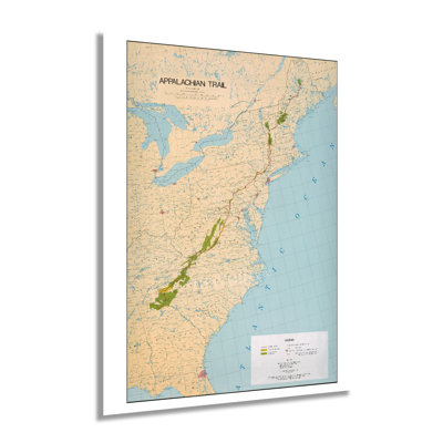
Stretching from Springer Mountain in Georgia to Mount Katahdin in Maine, the Appalachian Trail is one of the most iconic and famous trails in North America. Over two thousand miles along, the trail brings more than three million visitors annually. Thru-hiking the trail has become an increasingly popular attraction, with over three thousand hikers a year attempting to complete the entire journey on foot. The concept for the trail was conceived by Benton MacKaye, a forester who believed in preserving the natural elements found in the Eastern United States and allowing urban dwellers a chance to enjoy unspoiled nature.First conceived of in 1921 and started in 1923 the entire project took nearly fifteen years to finish. The trail features some of the most iconic natural imagery in America and is traverses fourteen states. A thru-hike can take anywhere from five to seven months and was first completed in 1968. The trail is maintained by the Appalachian Trail Conservancy, which keeps accurate maps and information available for tourists and hikers. The most isolated portion of the trail is the last section of the Maine portion and is known as the “Hundred Mile Wilderness.” Maine also requires hikers to cross the Kennebec River by boat, the only such crossing.This authentic piece of the trail’s history illustrates the comprehensive route in comprehensive detail. Its distinguished aesthetic is characteristic of the Appalachian Trail Project Office productions based in Harpers Ferry, West Virginia, and features a signature minimal style.Our museum quality giclee print comes printed with archival ink on premium heavyweight matte paper. This eye-catching vintage map reproduction print makes the perfect gift for anyone that loves history and imagery.
Looks great with the frame I purchased.. Joseph. Palm City, FL. Sun Jul 28 2024

FREE Delivery
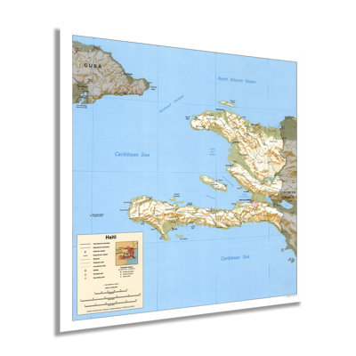
Located on the island of Hispaniola and sharing a border with the Dominican Republic, Haiti has a distinctive culture and rich history. The nation achieved sovereignty from French colonial rule in 1804 and became the first independent nation in the Caribbean and Latin America. This Central Intelligence Agency map shows Haiti in the so-called Post-Duvalier era. In 1994 the United States began negotiations with military leaders to allow the peaceful entry of twenty-thousand American troops. These efforts allowed for the restoration of democratic leadership under Jean-Bertrand Aristide, who had been ousted by military forces following his election in 1990. The coup forced many Haitians to attempt to flee the island.Aristide planned to enact free-market reforms in an effort to improve the Haitian economy, though it achieved mixed results, which in many cases did not improve local communities. In November of 1994, the island suffered massive casualties following mudslides caused by Hurricane Gordon. Haiti has long been used to export agricultural products to markets across America and Europe and was the first island discovered by Columbus in 1492. Spain laid claim to the region through French efforts would eventually lead to Spain ceding the western portion of Hispaniola. Under French colonial rule, sugarcane farms were established to meet growing demand.Haiti’s unique culture blends Spanish, French, Indigenous, and African cultures into a distinctive mix that remains one of the most unique in the western world. This map displays Haiti in a period of significant transformation.Our museum quality giclee print comes printed with archival ink on premium heavyweight matte paper. Shipped in a sturdy cardboard tube your print will arrive ready to be framed. This eye-catching vintage map reproduction print makes the perfect gift for anyone that loves history and imagery.

FREE Delivery
Produced under the direction of the third US National Park Director Arno B. Cammerer, this base map of the iconic Great Smoky Mountains was released in the same year as the park’s opening in 1934. President Franklin Roosevelt officially opened the park in a ceremony held at the Newfound Gap. Unlike its predecessors Yellowstone and Yosemite, the Great Smoky Mountain National Park required the federal government to purchase large tracts of land from small farms, loggers, and established communities throughout the Appalachian region. With over eleven million visits annually, the Great Smokies the most popular of all American national parks.The unique aesthetic and distinctive style of these federally produced maps immediately transports the viewer back in time and links the past and present. These are pieces of cartographical History and demonstrate the evolution of American History and how culture evolved throughout the nineteenth and twentieth centuries to preserve sites of biological and cultural significance. The park contains more than seventy-five historical structures to tell the story of the settlers that farmed and lived off the land from the late nineteenth century on. These include churches, gristmills, schools, homes, and other agricultural and farming structures.With nearly two hundred thousand acres of old-growth forest, the Great Smoky National Park is the largest east of the Mississippi River and contains the densest population of black bears in the eastern United States. The Smoky nickname is derived from a natural fog caused by the region's distinct flora and fauna.Our museum quality giclee print comes printed with archival ink on premium heavyweight matte paper. This eye-catching vintage map reproduction print makes the perfect gift for anyone that loves history and imagery.

FREE Delivery
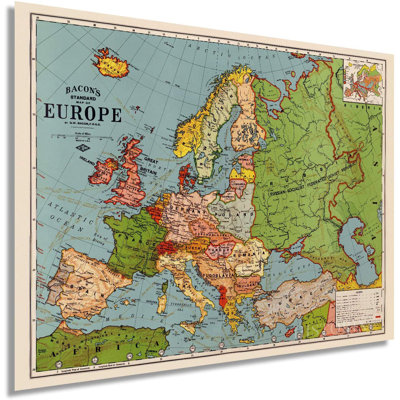
This distinctive illustration of Europe in 1925 bears the aesthetic of American cartographer George Washington Bacon, whose unique style would remain in vogue until the mid-1950s. Produced only six years after the Treaty of Versailles officially ended World War I, this map depicts Europe in a period of significant transition and growth. While the United States was experiencing the so-called ‘Roaring Twenties,’ with fashion and societal progressiveness, Europe was starting to rebuild after the devastation of the War. This rebuilding would allow countries like France to experience a renaissance of the arts, literature, and cultural dynamism. The War had an unintended consequence of causing an economic boom, and by 1925 this boom was felt throughout Europe, and nations were flourishing. National boundaries were re-established following the War, with Poland emerging as a sovereign nation, as well as the foundation of the multinational state, which would eventually become Yugoslavia. Czechoslovakia was formed by merging the former Kingdom of Bohemia with parts of the Kingdom of Hungary to become yet another new independent nation. Russia became the Soviet Union and Finland, Estonia, Lithuania, and Latvia received independence. In many ways, the eruption of World War I marked the transition of Europe, and the rest of the world into modernity. The War saw the last to see horses in combat and the first to see aviation used in military campaigns. This unique depiction of Europe in this period is immediately recognizable and is truly an authentic piece of cartographical history.

FREE Delivery
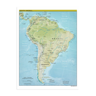
With the majority of its population concentrated in the coastal regions, South America’s iconic geography and unique features have defined the development, cultural evolution, and history of the continent. A long history of colonialism has left the majority of South Americans speaking Portuguese or Spanish with a culture that evolved from European influences combined with native traditions and beliefs. Brazil remains the economic and cultural center of South America and is the largest in both size and population. The geography of South America varies significantly from the subtropical rainforest of the Amazon Basin to the southern tip terminating in Patagonia on a rocky shoreline. The twenty-first century saw an increase in the call for interregional cooperation to provide economic relief and collaboration between nations to create a more equitable society. The rise of military dictatorships throughout the 1960s and 70s has caused the content significant strife, and the political revolt following led to periods of considerable turmoil both politically and civically. The 1980s saw a shift toward democratically elected leadership which has remained the norm to this day.The Central Intelligence Agency is known for producing the most accurate geopolitical maps for use by political figures, military leaders, and international business relations. They reflect the most current international boundaries and the most accurate cartographical details which had become stable in the twenty-first century. The distinctive aesthetic makes this piece immediately recognizable, and the signature style of the CIA’s minimalist depictions is demonstrated with crisp lines and muted tones.Our museum quality giclee print comes printed with archival ink on premium heavyweight matte paper. This eye-catching vintage map reproduction print makes the perfect gift for anyone that loves history and imagery.

2 Sizes
By Williston Forge
24" H x 18" W x 0.01" D
FREE Delivery
VINTAGE MAP REPRODUCTION: You’ll love this high quality historic reproduction of 1797 Ireland Map Poster. Our museum quality prints are archival grade, which means it will look great and last without fading for over 100 years. Our print to order maps are made in the USA and each map is inspected for quality. This beautiful artwork is a perfect addition to your themed decor. Vintage maps look great in the home, study or office. They make a perfect gift as well.

FREE Delivery
The largest city and capital of Manitoba, Winnipeg, has a rich history and distinct culture influenced by the early French trappers who settled in the region in the eighteenth century. Located at the confluence of the Red and Assiniboine rivers, Winnipeg was a hub for trading for centuries and became known as the "Gateway to the West." The arrival of the Canadian Pacific Railway in 1881 further expanded access, and immigrants from across Western Europe flocked to the city to find welcoming communities based on cultural traditions. Winnipeg was first incorporated in 1873 and experienced a dramatic growth in population during the latter portions of the eighteenth and early parts of the twentieth century. In 1881 a boom in commercial development occurred that brought more residents and made the city an important economic center for the region in the following decades. Because of its role as a transportation hub Winnipeg developed a thriving wholesaling industry in the late nineteenth century that remains to this day. Winnipeg also developed a flourishing grain trade that was spurred by the vast fields surrounding the city and the seasonal climate, and settlers from Europe brought their farming techniques and skills during the preceding century. Bird's eye perspectives were widely popular during the eighteenth century and bear a distinctive aesthetic and unique style that immediately transports the viewer back in time, creating a link between the past and present. This detailed piece of Canadian cartographical history depicts Winnipeg's significant growth during the eighteenth century.

2 Sizes
By Williston Forge
24" H x 18" W x 0.01" D
FREE Delivery
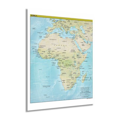
HISTORIC PRINTS: You’ll love this high quality print of 2021 Africa Map. Our museum quality prints are archival grade, which means it will look great and last without fading for over 100 years. Our print to order maps are made in the USA and each map is inspected for quality. Maps are great for education in the classroom. Maps also make for beautiful wall art in the home, study or office. A great gift for travelers or map enthusiasts.

FREE Delivery
Produced by the Central Intelligence Agency to maintain the most current international time zones, this unique map allows business, political leaders, military, and other organizations access to the most up-to-date information for policy planning and strategy. CIA maps are esteemed for their incredible accuracy and have become an invaluable part of the agency's intelligence program. Only ten countries recognize more than one time zone at a given time in their national boundaries. The unique aspect of this depiction is the prominence of the time zone boundaries that supersedes geopolitical boundaries. The CIA produces one of the most varied ranges of maps and has been the leader in geopolitical mapmaking since its inception in 1941. Created in 2021 during a period of significant international uncertainty, this map bears a signature CIA style that features minimal embellishments and a crisp, minimal style. The alternating color scheme makes this production immediately recognizable as a CIA piece. As digitization efforts and satellite imagery became more prevalent, physical maps remain one of the best examples of the agency's progress, evolution, and development. The CIA is synonymous with accurate international data surveillance. As the bureau grew throughout the twentieth and twenty-first centuries, they have produced some of the most essential information utilized by officials at the highest levels of the military and government. This is an authentic piece of modern cartographical history that shows the world in a time of progress, and technological evolution as governments across the globe addressed unprecedented new challenges.Our museum quality giclee print comes printed with archival ink on premium heavyweight matte paper. Shipped in a sturdy cardboard tube your print will arrive ready to be framed. This eye-catching vintage map reproduction print makes the perfect gift for anyone that loves history and imagery.

FREE Delivery
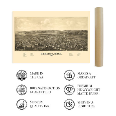
Produced and published by Lucien Burleigh, this birds eye perspective depicts Amherst in a period of significant growth, prosperity, and transformation as the nation recovered from the Civil War and rushed to the turn of the twentieth century. Burleigh was one of the most prolific cartographers of his era and produced numerous works throughout the Northeast. His maps are found in the Smithsonian American art Museum and the Boston Public Library. These maps served as marketing materials and were used to promote prominent civic features, historical buildings, educational institutions, and economic features to attract residents and merchants alike. The first Europeans to explore the Amherst region date back to 1665 though permanent settlements were not established until 1727. The region remained an important hub for raising livestock in the vast grazing areas found in the Pioneer Valley. By 1886 the region had become known for its educational institutions, and the Massachusetts Agricultural College became an important leader in scientific methods applied to traditional farming and grazing techniques. Amherst remains one of the most historically significant and iconic towns of the Northeast and is known for its deep roots in American literary and poetic history. Amherst is the birthplace of famed nineteenth-century poet Emily Dickinson, and Robert Frost taught poetry at the eponymous University and retired in the town.This is an authentic piece of American cartographical history that bears a signature style and immediately transports the viewer back in time, creating an indelible bond between the past and present.Our museum quality giclee print comes printed with archival ink on premium heavyweight matte paper. Shipped in a sturdy cardboard tube your print will arrive ready to be framed. This eye-catching vintage map reproduction print makes the perfect gift for anyone that loves history and imagery.

FREE Delivery
Produced by Herman Brosius at only twenty-four years old, this stunning depiction of Brantford, Ontario, shows the city in a period of significant growth as industrialization saw numerous factories and manufacturing facilities founded on the banks of the Grand River. This unique birds-eye perspective served as marketing material to attract both residents and merchants. Known as the Telephone City, Brantford is the hometown of Alexander Graham Bell, who invented the first phone at his father’s homestead, the Melville House. The construction of a railroad in 1854 further expanded access to the city and spurred more population growth.Birdseye perspectives were a popular illustration style throughout the nineteenth century and bear a distinctive aesthetic and unique style that immediately transports the viewer back in time, creating an indelible bond between the past and present. Since the arrival of European settlers in the 1820s, the region developed a unique culture that blends indigenous traditions and heritage with western culture. The city was named after Mohawk leader Joseph Brant, who allied with the British during the American Revolution.Brosius produced numerous works from his brothers print shop based in Milwaukee, and his focus was mostly on the Northern areas of America and southern Canada. However, he did produce works in Texas during the late nineteenth century. Though they were not produced to scale, panoramic maps featured prominent civic features and notable buildings. This publication shows the city on the verge of significant cultural, economic, and political transformation during the late nineteenth century.Our museum quality giclee print comes printed with archival ink on premium heavyweight matte paper. This eye-catching vintage map reproduction print makes the perfect gift for anyone that loves history and imagery.

2 Sizes
By Williston Forge
36" H x 24" W
Rated 5 out of 5 stars.1 total vote
FREE Delivery
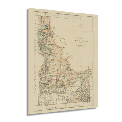
Settled primarily by French fur trappers during the eighteenth and early nineteenth century, Idaho was officially recognized as an American Territory in 1846. It was included in the Oregon Territory until Oregon achieved statehood in 1849. At that point, Idaho was included in the Washington Territory. Idaho officially became a state in 1890 and maintained a local economy that relied on lumber milling, fur trapping, and farming in its fertile valleys. This map was one of the first published following statehood and was created by the noted and prolific Julien Bien Company, which published numerous depictions of the American West.Bien maps are recognizable due to their classic style and minimal aesthetic. As the turn of the century neared, Idaho remained a relatively remote area that relied on local trading to support a regional economy. To this day, Idaho remains one of the most rugged terrains in the United States. It contains some of the last unspoiled natural areas, including the Franck Church-River of No Return Wilderness Area, the largest protected contiguous land. The iconic Snake River flows through the Snake River plain in southern Idaho and is an integral part of the Columbia River’s tributary system. While the Eastern United States was experiencing a boom in manufacturing during the Industrial Revolution, Idaho remained a predominantly agricultural region supplying major markets with crops like potatoes and wheat. This is an authentic piece of American cartographical history that depicts one of the most pastoral regions in the United States.Our museum quality giclee print comes printed with archival ink on premium heavyweight matte paper.
So cute. Kristina. Coeur D Alene, ID. Sun Apr 06 2025

FREE Delivery
Generated in 2001, this map of present-day Vietnam details the roads, railways, and international borders. Created by the CIA, there are also lays out the cities and transportation routes in Cambodia, Laos, Thailand, and southern China. Significantly Vietnam amended its constitution in 2001, which had been initially enacted in 1992. The history of Vietnam is rich and storied, dating back to the Paleolithic era. The first colonizers in the region were the Portuguese, who established a presence as early as 1500 and erected a stone stele to mark their discovery. Trade routes were built in the area, and exploration and colonization continued, eventually leading to the French rule of what was then considered Indochina. Divided between North and South, Vietnam was in turmoil following a Japanese occupation during World War II. July 1845 marked the division of the country at the 16th Parallel to allow for a Japanese surrender. By August, the country had devolved into rioting and anarchy with the collapse of Saigon’s administrative capabilities. The ensuing French- Indochina wars would be hard-fought through the 1940s and 1950s until the defeat of the French and loyalists in the 1954 Battle of Dien Bien Phu, which resulted in the creation of Cambodia and Laos as well as the division of the country at the 17th Parallel. The region would then endure the Vietnam war and re-unify in 1976, creating the Socialist Republic of Vietnam. By 2001 Vietnam had made reforms and was on target to become one of the fastest-growing economies in South Asia.

5 Sizes
By Wrought Studio™
36" H x 24" W x 0.05" D
Rated 5 out of 5 stars.1 total vote
FREE Delivery
This wall art is uniquely designed and crafted by cartographic artists. It's printed on high-quality matte paper. Affix this to your wall and let it become a great accent to your space.
I love this print.. Kellyn. Westminster, CO. Sun Nov 22 2020

2 Sizes
By Williston Forge
24" H x 36" W
Rated 5 out of 5 stars.1 total vote
FREE Delivery
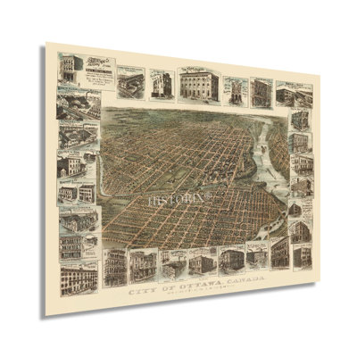
Produced and published by the Toronto Lithographing Company in a period of considerable transformation, growth, and prosperity, this stunning depiction of Canada's Capital City bears a distinctive aesthetic and unique style. Birds eye perspectives were produced to market cities across North America to prospective residents and merchants and featured prominent civic and geographic features. Their signature aesthetic immediately transports the viewer back in time, creating an indelible bond between the past and present. This map contains many notable buildings in the margins showcasing the thriving manufacturing and milling industries that were attracting immigrants from the United States, Europe, and rural Canada. Located at the confluence of three major rivers, Ottawa sustained a vital trade and travel route for thousands of years which continues to this day. Queen Victoria designated Ottawa as the nation's Capital in 1857, and it had been a critical stronghold for the British during the War of 1812. The city enjoyed a thriving lumber market from the 1850s driven by large mills located on the river banks that would eventually become some of the largest sawmills in the world. In 1886 the city was connected to the transcontinental railroad via lines that connected in Hull and Lachute in Quebec. By 1885 Ottawa was the only city in Canada with an electric grid that served the entire downtown, and it was thriving during the Gilded Age as Canada and the United States raced towards the turn of the century. This piece is truly an authentic piece of Canadian cartographical history.Our museum quality giclee print comes printed with archival ink on premium heavyweight matte paper.
Great quality. Jacob. Ottawa, ON. Wed Feb 26 2025

FREE Delivery
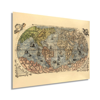
Produced and published by Venetian engraver and painter Ferrando Bertelli, this renaissance work is a genuine piece of cartographical history, and one of the earliest depictions go the entire globe. Bertelli was active for nearly five decades, and his distinctive style and unique aesthetic distinguish this work as a classic depiction from the renaissance era. This period of enlightenment, modernization, and transition was associated with significant social change throughout Europe. Bertelli’s ornate flourishes, including sailing vessels and used various colors to distinguish land and sea, were remarkable for the period and immediately transport the viewer back in time, creating an indelible bond between the past and present.This work was donated to the Library of Congress by well-known American businessman and Philanthropist Lessing J. Rosenwald in 1979 at the direction of his estate. Lessing’s private collection held thousands of rare antiquities, including maps, paintings, books, and the “Giant Bible of Mainz,” which has been on permanent display at the entrance to the Library of Congress since Rosenwald’s donation in 1951. The renaissance period is considered one of the most important for cartographic history as scientific advances, classical mapping techniques, and expanding trade routes allowed engravers greater access to geographical data combined with advances in mathematics changed the fundamental concept of the map. As maps became more accurate, explorers were able to travel further and discover new regions. Advances in printing techniques also allowed greater access to physical maps, spurring their production and distribution across Europe and North America. Our museum quality giclee print comes printed with archival ink on premium heavyweight matte paper. This eye-catching vintage map reproduction print makes the perfect gift for anyone that loves history and imagery.

FREE Delivery
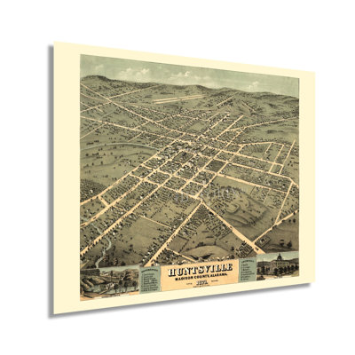
Produced and published by one of the early pioneers of the form, Albert Ruger, this birds eye perspective depicts Huntsville, AL, in a period of significant growth and transformation during the years following the conclusion of the American Civil War. Ruger’s works inspired other cartographers to adopt the style, and they became one of the most popular cartographic styles of the mid-nineteenth and early twentieth centuries. Panoramic maps served as marketing materials and featured prominent civic buildings, religious and educational institutions, as well as cultural and economic attractions. They were geared to entice residents and merchants alike. Huntsville was founded in 1805 by European Americans and officially incorporated in 1811. After the Civil War ended, Huntsville became an important regional textile milling center, and workers from across the South came to the city eager for work in the numerous factories that were being established. They formed neighborhoods and communities along cultural lines, many of which exist to this day. These small communities would continue to grow as Huntsville became an important regional center during the nineteenth and twentieth centuries. During World War II, the US Army established the Huntsville Arsenal in the area. This caused a surge in population as some twenty-thousand workers were needed to construct the housings for chemical munitions and other critical infrastructure. This is an authentic piece of American cartographical history with a unique aesthetic and classic style that immediately transports the viewer back in time, creating an indelible bond between the past and present.

FREE Delivery
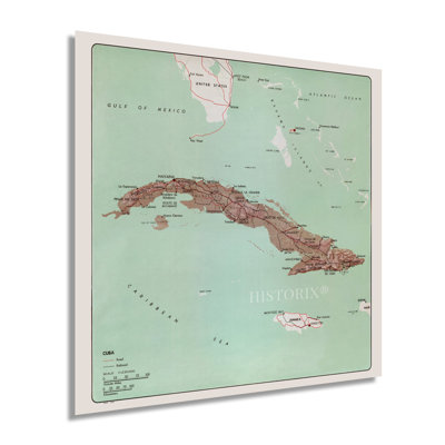
Located at the confluence of the Caribbean Sea, Gulf of Mexico, and the Atlantic Ocean, Cuba is one of the most iconic islands in the western world. Published by the Central Intelligence Agency at the height of the Cuban Missile Crisis, this depiction is a rare piece of international cartographical history. Following the ousting of Dictator Fulgencio Batista by Fidel Castro in 1959, Cuba became one of the few Marxist-Leninist states. This led to significant tension between Cuba and the United States and would result in decades of economic sanctions and political opposition.The Cuban Missile Crisis was a brief political conflict between the two nations as the Soviet Union matched missile defenses in Cuba to those installed by the US in Italy and Turkey. This remains one of the defining moments of the Cold War and the closest it came to escalating to a full-blown war. United States President John F. Kennedy chose to go against his military advisers and ordered a naval quarantine of the island to prohibit food and other aid from being imported instead of an air attack followed by a full-scale invasion. By calling this measure a quarantine instead of a blockade, the United States avoided committing an act of war.CIA maps are unique for their uniform aesthetic and precise attention to detail and geopolitical boundaries, which represent the most current borders. Top-ranking political and military leaders utilize them to develop foreign policies, international relations and implement military strategies.Our museum quality giclee print comes printed with archival ink on premium heavyweight matte paper. Shipped in a sturdy cardboard tube your print will arrive ready to be framed. This eye-catching vintage map reproduction print makes the perfect gift for anyone that loves history and imagery.

FREE Delivery
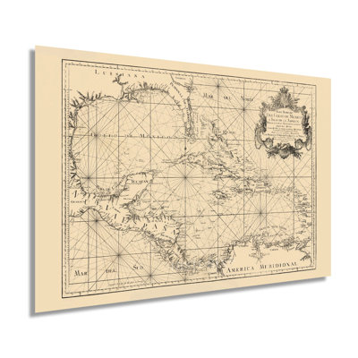
Produced by noted Spanish geographer and cartographer Tomas Lopez de Vargas Machuca in 1755, this ornate depiction of the maritime features of the Gulf of Mexico and the Caribbean Sea contains remarkable detail, accuracy, and longitudinal elements. These productions would have been invaluable tools for merchants, explorers, and naval sailing vessels both in North America and for reference in Europe. After completing his training in Paris in 1752, Machuca sailed west to map the extensive nautical features of the Spanish holdings in the region. In 1795 Machuca compiled the Geographical Atlas of Spain, the first comprehensive atlas of all maps produced to that date. The work was completed by his son in 1804 and remains one of the most important pieces of European cartographical history. Spanish settlement throughout the Caribbean and what would eventually become the Southern portion of the United States was extensive, extending from Florida to Texas and Mexico. They would maintain a powerful presence in the region until the end of the eighteenth-century. Machuca would complete more than sixty maps throughout his career, and he was one of the most prolific Spanish cartographers of his time.Since Columbus first landed in the Caribbean, the region has served as an important trading hub for imports and exports to Northern America. Control of the area was essential for establishing trade routes to Europe. This led to the development of diverse cultures drawing from European, Native, and African influences. Machuca's stunning depiction remains one of the most distinct examples of the region.Our museum quality giclee print comes printed with archival ink on premium heavyweight matte paper. This eye-catching vintage map reproduction print makes the perfect gift for anyone that loves history and imagery.

FREE Delivery
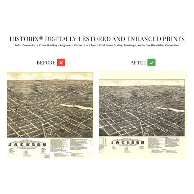
Produced and published by one of the early pioneers of birds eye perspectives, Albert Ruger, this depiction of Jackson, Michigan, shows the city in a period of significant growth and transformation. Founded in 1829, the city is the seat of Jackson County and was named after President Andrew Jackson. Some forty miles west of Ann Arbor, Jackson was an early manufacturer of automobiles and had long been one of Michigan's manufacturing hubs. The city enjoyed a robust transportation infrastructure in the nineteenth century which spurred economic prosperity and attracted immigrants from across Europe who established neighborhoods and communities along cultural lines, many of which exist to this day. Birds eye perspectives were produced as marketing materials to promote civic buildings, religious, educational, and cultural institutions, as well as other economic and geographic features to attract residents and merchants alike. They bear a unique aesthetic and distinctive style that is immediately recognizable and transports the viewer back in time, creating an indelible bond between the past and present. The latter portion of the nineteenth century saw the completion of numerous railroads in the area and allowed for a thriving trade industry to expand.By 1881 Michigan had experienced a considerable influx of residents from America and Europe and developed a distinct culture that was shifting from agriculture to manufacturing as the nation began the so-called Gilded Age. This is an authentic piece of American cartographical history that captures a snapshot of one of the most iconic regions in the country.Our museum quality giclee print comes printed with archival ink on premium heavyweight matte paper. This eye-catching vintage map reproduction print makes the perfect gift for anyone that loves history and imagery.

FREE Delivery
Produced and published by one of the more prolific birds eye perspective illustrators of the nineteenth century, J.J. Stoner, this stunning depiction of Colorado Springs and the surrounding areas shows the cities in a period of significant growth and transformation. Founded after the Peaks Gold Rush in the late 1850s, the area was being settled by a large influx of English immigrants who established neighborhoods and communities along cultural lines, many of which exist to this day. Now, the second-most populous city in Colorado, the city bears a unique culture and served as the territorial Capital during the state's early years.Birdseye perspectives were widely popular during the nineteenth and twentieth centuries and served as marketing materials to promote prominent civic features, religious and educational institutes, and geographic attractions. The arrival of railroads in 1871 opened access and allowed for a population boom and increased tourism due to the region's proximity to Pikes Peak and the Southern Rocky Mountains. Stoner worked closely with Albert Ruger, whose collection was purchased by the Library of Congress in 1941 and contained some of the most prominent panoramic maps of cities across America. Colorado Springs began annexing the surrounding cities to form a larger municipality in the 1880s and, by the turn of the century, had grown to more than twenty-thousand residents. This is an authentic piece of American cartographical history that immediately transports the viewer back in time, creating an indelible bond and link between the past and present.Our museum quality giclee print comes printed with archival ink on premium heavyweight matte paper. This eye-catching vintage map reproduction print makes the perfect gift for anyone that loves history and imagery.

2 Sizes
By Williston Forge
24" H x 18" W x 0.01" D
FREE Delivery
VINTAGE MAP REPRODUCTION: You’ll love this high quality historic reproduction of 1863 Montreal City Map. Our museum quality prints are archival grade, which means it will look great and last without fading for over 100 years. Our print to order maps are made in the USA and each map is inspected for quality. This beautiful artwork is a perfect addition to your themed decor. Vintage maps look great in the home, study or office. They make a perfect gift as well.

By Trinx
FREE Delivery
Historic is guarding the constant ingenuity of historic maps in the form of vintage wall art.

2 Sizes
By Williston Forge
18" H x 24" W
FREE Delivery
Produced and published by prominent London-based bookseller, geographer, and engraver William Berry this distinguished publication is a rare piece of early cartographical history. During the seventeenth century, numerous expeditions were discovering land across the globe, including in the America’s, South East Asia, and the Pacific and Indian Oceans. The Mediterranean Sea remained a focal point for European cartographers, and detailing it with greater accuracy became the primary goal for illustrators and geographers across Northern and Western Europe. The distinctive style, ornate flourishes, and incredible detail immediately transport the viewer back in time, creating an indelible bond between the past and present. Berry was unique as a cartographer in the seventeenth century as it was primarily a craft conducted by the Dutch, whose competency was unrivaled at the time, save for a select few, Berry included. Berry’s career would span more than four decades, and he was one of the most prolific English cartographers of his time. The Mediterranean Sea’s significance and history are undeniable, and it remains one of the most critical regions to this day. Early civilizations utilized the relatively calm sea to spread knowledge, trade goods, and travel throughout Africa, Europe, and the Middle East. The opening of the Suez Canal in 1868 further increased access to Asia as ships no longer had to sail south past the Cape of Good Hope on Africa’s southernmost coast. The cultural and historical significance of the Mediterranean Sea and its iconic coasts are given new context with this antique production.Our museum quality giclee print comes printed with archival ink on premium heavyweight matte paper.

FREE Delivery
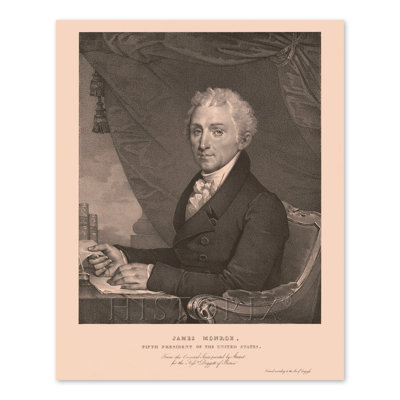
Fifth President of the United States, James Monroe, was the last of the Founding Fathers to serve in the office as well as the final President of the so-called Virginia dynasty. His greatest legacy, the Monroe Doctrine, opposed European colonialism in North America and asserted the United States' dominion over the American west leading to further settlements. Monroe, under third President Thomas Jefferson's tutelage, successfully negotiated the Louisiana Purchase in 1803, which doubled the claimed territory of the United States. Monroe was born in Virginia and served in the Continental Army during the American Revolution.Monroe served as fourth President James Madison's Secretary of State during the War of 1812, and his service made him the obvious choice for the Presidency in the election of 1816. Monroe was responsible for bringing statehood to Florida and Missouri, and his policies were conciliatory towards the British while hostile towards Spanish expansion into North America. Monroe was elected Senator in 1790 but left his post in 1794 to serve as the Ambassador to France under first President George Washington. During Monroe's first term as President, the opposing Federalist Party collapsed, ensuring his victory in the subsequent election in 1820.This print produced by American artist Gilbert Stuart is another link to America's political history as Stuart had produced portraits for all four preceding presidents establishing a tradition that remains to this day. The distinctive style and classic aesthetic make this piece a part of American history that links the viewer to the past.

FREE Delivery
Leavenworth was the first incorporated town in the Kansas territory and was established in 1854 as westward expansion became increasingly popular, though the military installation Fort Leavenworth had been an essential outpost since 1827 for supplying other forts in the American West. Its location on the Missouri River also made it an ideal gateway for residents beginning their journey and stocking up on essential supplies. This bird's eye perspective was published only four years following the conclusion of the American Civil War, and Leavenworth was a critical source of Union Troops during the conflict. Produced and published by Albert Ruger, who was an early pioneer of the form, this panoramic map bears a distinctive aesthetic and classic style combined with bold colors and incredible detail to transport the viewer back in time, creating an indelible bond between the past and present and capturing a moment in the distinct evolution of the Kansas City metropolitan area. Bird's eye perspectives were produced as marketing materials to promote prominent civic buildings, natural attractions, and economic opportunities in an effort to entice residents and merchants alike. Ruger was born in Prussia, though his offices were based in Chicago, where he produced numerous depictions of towns and cities across the Midwest during the nineteenth century. The years after the Civil War saw a significant transformation for the region as the population grew and many new neighborhoods were established along cultural lines which exist to this day. This is an authentic piece of American cartographical history.

FREE Delivery
Produced and published by one of the most prolific illustrators of panoramic maps, Henry Wellge, this stunning depiction of Salt Lake City shows the iconic western state in a period of significant transformation. Wellge’s unique style was widely popular during the latter nineteenth and early twentieth century. Birdseye perspectives served as marketing materials to attract residents and merchants alike. They featured prominent civic, economic, and geographic features. These illustrations bear a distinctive style that is immediately recognizable and transports the viewer back in time. Wellge was one of six cartographers responsible for more than half of all American birds-eye perspectives.The cities settlement began in 1847 with the arrival of the Latter Day Saints. The original settlers attempted to form a recognized nation. However, the United States did not comply and established the Territory of Utah in 1850, which was considerably smaller in size. At the time of this map’s publication, Utah was still not formally recognized by the United States, though it would achieve statehood in 1896 and establish Salt Lake City as its Capital. The city experienced a period of growth in the late nineteenth century when it was connected to the Transcontinental Railroad, which expanded access. This growth was marked by the establishment of diverse communities throughout the city based on cultural lines, many of which exist to this day. Birdseye perspectives are historically significant representations of cartography, society, and technological advances during the 1800s. Wellge’s maps are distinguished by their detail and artistic flourishes.Our museum quality giclee print comes printed with archival ink on premium heavyweight matte paper. Shipped in a sturdy cardboard tube your print will arrive ready to be framed. This eye-catching vintage map reproduction makes the perfect gift for anyone that loves history and imagery.
2 Sizes
By Williston Forge
24" H x 36" W x 0.01" D
FREE Delivery
VINTAGE MAP REPRODUCTION: You’ll love this high quality historic reproduction of 1883 Map of Wyoming. Our museum quality maps are archival grade, which means it will look great and last without fading for over 100 years. Our print to order maps are made in the USA and each map is inspected for quality. This beautiful artwork is a perfect addition to your themed decor. Vintage maps look great in the home, study or office. They make a perfect gift as well.

FREE Delivery
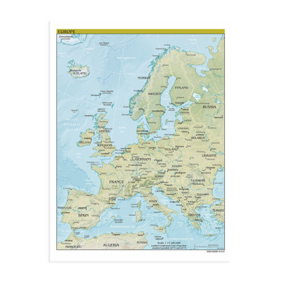
Though the second smallest continent in landmass, Europe comprises nearly ten percent of the global population and has been the center of Western culture for centuries. European culture traces its roots to Ancient Rome and Greece, and the fall of the Roman Empire in 476 AD led to the end of the ancient era of Europe and sparked the Migration Period, which saw growth and expansion further into the central and coastal regions of modern-day Spain, Portugal, Germany, England, and France. Starting in the fifteenth century, the Age of Exploration saw European powers establish colonies and settlements across the globe, especially North America, following the discovery of Hispaniola by Columbus in 1492. The first European settlement in North America was established in 1493 in Santa Domingo, Dominican Republic.The nineteenth and twentieth centuries marked a period of significant transition in European global power as other international forces gained prominence and influence. Both World Wars occurred on European soil, which further contributed to an erosion of European dominance in global affairs. The foundation of the European Union in 1949 has been the leading unifier throughout European politics and economics for the duration of the twenty and twenty-first centuries. The Central Intelligence Agency produces the most accurate geopolitical maps for use by political and military leaders that illustrate the evolution and growth of nations and their defining boundaries. The minimal aesthetic and distinctive style are defining characteristics of CIA maps, and these are remarkable pieces of modern cartographical history.Our museum quality giclee print comes printed with archival ink on premium heavyweight matte paper.

FREE Delivery
By the time of this map’s publication, the San Fernando Valley had seen rapid expansion and an economic shift from a largely agrarian community with vast farms and ranches to a bustling suburb of Los Angeles following its annexation in 1915. The extension of the Pacific Electric Railroad in the early 1900s also increased access for residents to commute to central Los Angeles from the Valley. Three primary industries would come to dominate the area in the twentieth century, motion pictures, automobile production, and the beginnings of the aviation industry. As cities and municipalities were established during this time, the area developed a distant culture that was a blend of traditional Spanish and Indigenous traditions with contemporary American attitudes and beliefs.The San Fernando Valley experienced one of the most significant population booms of any region in America following the conclusion of World War II. Drawn to affordable housing and temperate weather as well as employment opportunities, Americans flocked to the area in the 1950s and 1960s and would create some of the most iconic West Coast imagery of the twentieth century. The unique geography of the Valley created numerous neighborhoods and independent cities that remain culturally significant to this day. War efforts during World War I caused the economy to move away from agriculture, and widespread suburbanization would come to define the San Fernando Valley during the early and middle portions of the twentieth century. This authentic piece of American cartographical history immediately transports the viewer back in time.Our museum quality giclee print comes printed with archival ink on premium heavyweight matte paper.

2 Sizes
By HISTORIC PRINTS
18" H x 24" W
FREE Delivery
Published four years after Guam was ceded to the United States by Spain, the postal map of the Western Pacific includes the Samoan Islands and Hawaii. As global trade increased, the importance of international mail became crucial to the world economy. The United States' interest in the Western Pacific facilitated the need for the establishment of naval outposts across the vast ocean. The Samoan Islands are an archipelago comprised of nearly 1200 miles and are home to one of the largest Polynesian populations. Europeans first made contact with Samoa in the late eighteenth century, and they were dubbed the Navigator Islands and would be until the 1870s as political interest in the area increased.The area would become one of the central focuses of the American military during World War II as fighting with the Japanese increased in the Pacific Theater. The entire region has been critical to global trade for centuries and bears distinct cultures that retain traditional values and norms influenced by Western culture. British explorer James Cook was the first European to make contact with native Hawaiians in 1778. Hawaii was made an official State in 1959 and is the most recent to join the Union. This map's distinct aesthetic and technical expertise is particularly notable given the vastness of the region and the difficulty of charting and mapping such a large area. This is an authentic piece of cartographical history with increased significance given its particular creation demonstrating international postal routes as the global economy grew and expanded.Our museum quality giclee print comes printed with archival ink on premium heavyweight matte paper.

FREE Delivery
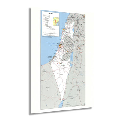
Following the conclusion and subsequent displacement of millions of Jewish people in the years after World War II, the Jewish State of Israel was established in Palestine and officially recognized by the newly formed United Nations in 1949. This destabilized Palestine as hard-line negotiators between settlers and established residents led to decades of conflict and attempts at resolution through political and military processes and international diplomacy. The 1970s and 80s saw continued conflict in the region as Jewish settlers established communities in the West Bank and Jerusalem, territories that both cultures highly value as traditional holy lands.The Central Intelligence Agency has produced the most detailed and accurate geopolitical maps since 1941. The CIA maintains a comprehensive collection that tracks, updates, and illustrates international boundaries, borders, and changes in political leadership. CIA productions bear a classic style with a minimal aesthetic and are immediately recognizable. As tensions in the regions heightened throughout the twentieth century, the United States supported Israeli independence and settlement, and in 1980 the Basic Law declared Jerusalem the capital of Israel. The 1980s also saw a marked increase in diversity in Israel as waves of settlers arrived from Ethiopia and Eastern Europe.While tensions remain high in the region, there have been continued efforts to reach a peace agreement between Israeli settlers and displaced Palestinians. This piece of cartographical history shows Israel and the surrounding areas in a period of significant transition as international policies and regional beliefs create an ever-evolving political and cultural landscape.Our museum quality giclee print comes printed with archival ink on premium heavyweight matte paper. This eye-catching vintage map reproduction print makes the perfect gift for anyone that loves history and imagery.

FREE Delivery
Stretching from Springer Mountain in Georgia to Mount Katahdin in Maine, the Appalachian Trail is one of the most iconic and famous trails in the United States. Over two thousand miles along, the trail brings more than three million visitors annually. Thru-hiking the trail has become an increasingly popular attraction, with thousands of hikers attempting to complete the entire journey on foot. The idea for the trail was conceived by Benton MacKaye, a forester who believed in preserving the natural elements found in the Eastern United States and allowing urban dwellers a chance to commune with nature.The first section of the trail was completed in 1923, and the entire project took nearly fifteen years to finish. The trail features some of the most iconic natural imagery in America and is traverses fourteen states. A thru-hike can take anywhere from five to seven months and was first completed in 1968. The trail is maintained by the Appalachian Trail Conservancy, which keeps accurate maps and information available for tourists and hikers. The most isolated portion of the trail is the last section of the Maine portion and is known as the “Hundred Mile Wilderness.” Maine also requires hikers to cross the Kennebec River by boat, the only such crossing.This is an authentic piece of cartographical history that illustrates the scope of one of America’s most iconic natural features. The minimal aesthetic is characteristic of the cartographical style of the time and the agency that produced it.Our museum quality giclee print comes printed with archival ink on premium heavyweight matte paper. Shipped in a sturdy cardboard tube your print will arrive ready to be framed. This eye-catching vintage map reproduction print makes the perfect gift for anyone that loves history and imagery.

FREE Delivery
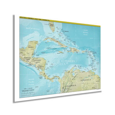
Published in a period of relative stability for Central America, this Central Intelligence Agency production depicts the geopolitical boundaries and distinct cultures that distinguish the region from its neighbors, the North and South. The region has long been under European colonial rule. Many nations achieved independence in the nineteenth and twentieth centuries, leading to a period of instability and social unrest due to varying economic factors. The distinct blend of indigenous language, traditions, and beliefs has been imbued with European influences since the discovery of North America by European settlers in 1492. Santa Domingo in modern-day Dominican Republic was the first European settlement in 1493 and remains the longest inhabited European settlement in Central America.Spain began to colonize the Americas further in 1609 and established numerous Catholic Churches throughout the region, which would become the predominant religion for the subsequent centuries. As part of the Mesoamerican biodiversity hotspot, Central America is home to a wide range of flora and fauna and contains some of the most active fault lines on the planet. Bordered by the Pacific Ocean to the west and the Caribbean to the East, the coastal regions of Central America stand in stark contrast to the interior geography, which is marked by tropical rainforests and mountainous features.CIA maps are regarded as the most accurate geopolitical depictions and are used by political and military leaders to develop and implement policy and strategy. During the early twenty-first century, Central America became an emerging market with relative political stability.Our museum quality giclee print comes printed with archival ink on premium heavyweight matte paper.

FREE Delivery
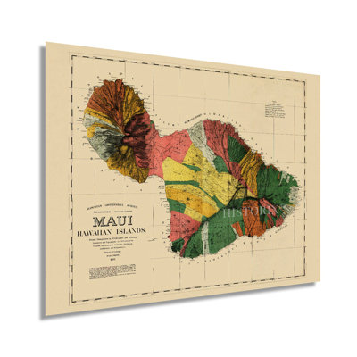
Produced by noted Hawaiian-born teacher, linguist, and cartographer William DeWitt Alexander one year after the formation of the Republic of Hawaii. This unique depiction of the second largest island shows it in a period of significant growth and transformation. The region had been producing sugar for the preceding two decades, and the local economy was growing exponentially with immigrants coming from Southeast Asia, Portugal, the United States, and Caribbean nations seeking agricultural employment. Missionaries had been coming to the island to establish churches throughout the islands, and DeWitt’s parents were among these groups. The island was annexed by the United States in 1898 and became a territory in 1900. The territory would not achieve statehood until 1959 and experienced a massive population boom during World War II.This was the first map of Maui printed by the Hawaiian government and took contributor Frank Dodge nearly six years to compile DeWitt’s surveys. The distinctive style, close attention to detail, and accuracy of the rugged coastlines immediately transport the viewer back in time and creates an indelible bond between the past and present.Prominent American mapmaker Julius Bien printed five hundred copies which were released in 1886. This map stands out due to the accuracy of the surveys used for the coastlines, which are iconic for their rugged landscapes and numerous valleys. Hawai’i has become one of the most recognized places in the United States, and tourism has been central to the economy during the nineteenth and twentieth centuries.Our museum quality giclee print comes printed with archival ink on premium heavyweight matte paper. Shipped in a sturdy cardboard tube your print will arrive ready to be framed. This eye-catching vintage map reproduction print makes the perfect gift for anyone that loves history and imagery.

2 Sizes
By Williston Forge
24" H x 18" W x 0.01" D
FREE Delivery
HISTORIC PRINTS: You’ll love this high quality print of 2021 Middle East Map Poster. Our museum quality prints are archival grade, which means it will look great and last without fading for over 100 years. Our print to order maps are made in the USA and each map is inspected for quality. Maps are great for education in the classroom. Maps also make for beautiful wall art in the home, study or office. A great gift for travelers or map enthusiasts.

2 Sizes
By Williston Forge
24" H x 18" W x 0.01" D
FREE Delivery
VINTAGE MAP REPRODUCTION: You’ll love this high quality historic reproduction of 1872 Dakota Territory Map. Our museum quality prints are archival grade, which means it will look great and last without fading for over 100 years. Our print to order maps are made in the USA and each map is inspected for quality. This beautiful artwork is a perfect addition to your themed decor. Vintage maps look great in the home, study or office. They make a perfect gift as well.

FREE Delivery
This remarkably detailed depiction of North America extends as far northwest as the remote regions of Russia and as far south as the subtropical rainforests of Nicaragua and El Salvador and truly displays the broad range of geographic features, distinct cultures, and vast expanses of territory. The inclusion of Greenland and Iceland also distinguishes this map from contemporary pieces, which often focus on the nations of Mexico, Canada, and the United States. At nearly a million square miles of landmass, North America is the third largest continent on earth, behind Africa and Asia. Due to European settlement and colonization since the fifteenth century, North America has developed many distinct cultures with influences from France, Spain, England, Western Europe, Africa, and Scandinavia. These cultures evolved in different nations, with Mexico remaining primarily influenced by Spain and the United States and Canada becoming more similar to England and Western Europe. However, much of Central America’s culture is a unique blend of indigenous traditions and Spanish influence. Following Columbus’ discovery of the island of Hispaniola, modern-day Haiti, and the Dominican Republic, the first European settlement was established at Santa Domingo in 1493 and remains the oldest continually populated colony in Northern America.The Central Intelligence Agency produces some of the most detailed, accurate, and sought-after maps for use by political leaders, the military, and international businesses to maintain proper records of geopolitical boundaries as they shift and evolve. This is an authentic piece of modern cartographical history with a signature style.Our museum quality giclee print comes printed with archival ink on premium heavyweight matte paper. This eye-catching vintage map reproduction print makes the perfect gift.

FREE Delivery
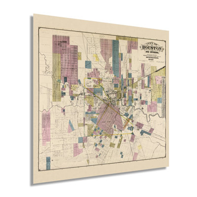
This unique depiction of Texas' largest and the fourth largest city in the United States shows it in a period of significant growth and transformation. As the city’s economy boomed due to the vast reserves of oil being pumped in East Texas, its culture flourished as the nation raced toward the turn of the century. Houston was first settled in 1837 at the junction of Buffalo and White Oak bayous and had grown tremendously by the end of the nineteenth century. The population had reached nearly sixty-thousand by 1900, and numerous economic drivers spurred the population from importing and exporting to manufacturing and oil field administration. Access had been increased with the completion of numerous railroads making Houston the first major hub in the American south in the years preceding the Civil War. In 1891 electric streetcars replaced mule-driven wagons as the primary source of transportation throughout the city’s downtown and burgeoning suburbs. This land use map shows the city becoming a modern icon of America synonymous with Texas' cultural identity. This depiction's unique aesthetic and signature style immediately transport the viewer back in time, creating an indelible bond between the past and present. Texas was readmitted to the Union in 1870 following the conclusion of the Civil War and had experienced no battles in the city during the conflict. This is an authentic piece of American and Texan cartographical history, and was produced by noted Houston-based surveyors Whitty and Stott and published by EB Noll.Our museum quality giclee print comes printed with archival ink on premium heavyweight matte paper. Shipped in a sturdy cardboard tube your print will arrive ready to be framed. This eye-catching vintage map reproduction print makes the perfect gift for anyone that loves history and imagery.

5 Sizes
By Wrought Studio™
20" H x 16" W x 0.05" D
Rated 5 out of 5 stars.1 total vote
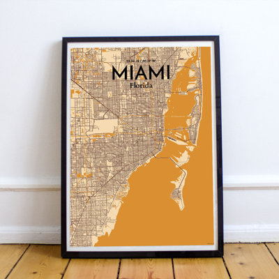
This wall art is uniquely designed and crafted by cartographic artists. It's printed on high-quality matte paper. Affix this to your wall and let it become a great accent to your space.
Ivy. Miami Beach, FL. Thu Jun 24 2021